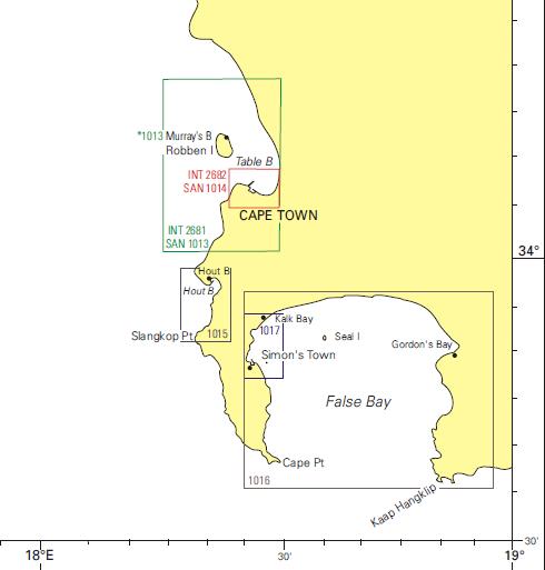
Cape Town has an amazing stretch of coastline. Knowledge of dive sites, beaches and where to dive is greatly enhanced by decent scale hydrographic charts. Besides their value to mariners and the general boating public whereby you have detailed information on what perils lurk below the surface waiting to wrench a piece out of the keel of your boat, they also offer great insight to where you may find interesting dive sites not listed on the “popular” dive site list. All you need to do is sign up for a few of the major dive centre newsletters to see that most of them go to the same places at the same time week after week.

The maps I have are:
- SAN 1017, scale 1:10 000, this covers the coast from Kalk Bay Harbour to Fisherman’s Beach
- SAN 1016, scale 1:50 000 which covers the entire False Bay area
- SAN 1015, scale 1:15000 covering Kommetjie, Hout Bay up to Sandy Bay
- SAN 1013, scale 1:36 000 covering the Table Bay area including Robben Island.
My favorite is SAN 1017 as this gives great detail on the areas I dive the most. The area it covers has many dive sites, some undived sites and many less popular sites. Any spot that seems interesting from the road, the dark patches you see from the beach could be kelp, rocky reef or some other manmade item from years gone by. Marine life gathers anywhere it can find even the slightest protection from predators, so a small kelp forest, an old submerged bridge foundation, or a wreck all attract marine life, many species setting up residence.
These maps are published by the SA Navy Hydrographic Office, and can be purchased from Chart World (telephone 021 419 8814) and Charts International (telephone 021 419 7700), both located on the foreshore in Foregate Square at the entrance to the harbour. The full chart catalogue can be found here.


Comments are closed.