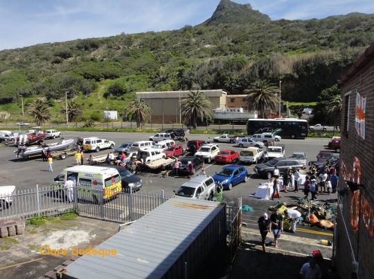
Boat dives in Cape Town are either done from Miller’s Point, Hout Bay, or (less frequently) Oceana Power Boat Club near the Waterfront. Tony is often asked for directions to the slipway in Hout Bay harbour, and I am the one who has to write them (being the native Capetonian!). Here they are for future reference:
Coming from Central Cape Town:
- Get onto Kloof Nek drive and follow it over the mountain until you can see Camps Bay below you.Turn left at Houghton Rd (500 metres).
- Slight left at Victoria Rd/M6, and carry on past the Twelve Apostles Hotel at Oudekraal, and Llandudno (9.4 km).
- Descend into Hout Bay and bear slight right to stay on Victoria Rd/M6
- Continue to follow Victoria Rd (1.8 km).
- At the roundabout, take the 2nd exit onto Harbour Road
- Continue down Hout Bay Harbour Rd.
- Turn left into the harbour entrance below the stone cliffs.
- Turn right at the booms and follow the road for no more than 200 metres until you see the slipway on your left, next to the NSRI building.
Coming from the Southern Suburbs (Rondebosch, Claremont, Newlands, etc):
- Get onto Constantia Nek, and at the top take the Hout Bay turnoff.
- At the first roundabout you get to in Hout Bay, take the 1st exit onto Main Rd/M6 (1.4 km)
- Drive past the mud soccer fields on your right, Kitima Restaurant and a petrol station on your left.
- At the next roundabout, take the 2nd exit onto Princess Street
- Directions as from Item 6 above.
Coming from the South Peninsula (Glencairn, Fish Hoek, Simon’s Town, etc):
- Follow Chapman’s Peak drive to its end in Hout Bay. The toll is about R40 unless your car is a bus.
- At the roundabout, take the 1st exit onto Princess Street.
- Directions as from Item 6 above.
Here’s an aerial view of the relevant parts of Hout Bay Harbour. The entrance road is right at the top of the map, in the middle. The slipway is more or less in the middle of the map, to the right of the dusty parking area. You’ll park your car in the parking area just at the top of the slipway, or in the dustbowl if the paved area is too full.
[googlemaps http://maps.google.com/maps?f=q&source=s_q&hl=en&geocode=&q=hout+bay+harbour&sll=-34.049944,18.345087&sspn=0.002227,0.003605&ie=UTF8&hq=&hnear=Hout+Bay+Harbour,+Hout+Bay,+Cape+Town,+Western+Cape,+South+Africa&t=h&ll=-34.050019,18.34587&spn=0.003111,0.00456&z=17&output=embed&w=425&h=350]


6 thoughts on “Directions to Hout Bay harbour launch site”
Comments are closed.