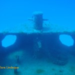
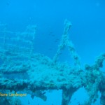
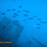
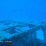
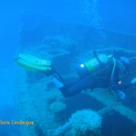
Of the ten dives we did in Malta, two were boat dives, done consecutively on one of the days. Our diving companions were all Russian, which meant that Sergey gave us our own personal dive briefing in English, and then switched to more stentorian tones to deliver the Russian version, with the assistance of Peter G. Lemon’s Malta diving book. The first of our boat dives, which were done in such style and comfort that we did not want the day to end, was to the Imperial Eagle, a small ferry that was deliberately scuttled as a diver attraction.
The ship’s wheel is still in place
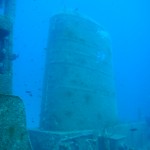
The Imperial Eagle is 45 metres long, 9.2 metres wide, and was 257 tons, powered by two oil engines. She was first launched in 1938 in England. The Imperial Eagle was a car and passenger ferry that could accommodate 70 passengers and 10 cars. Her maiden voyage between Malta and Gozo was in 1958, and she continued on this route for ten years. Afterwards she was used to transport cargo and animals between Gozo and Valletta.
The bow of the Imperial Eagle
The stern of the Imperial Eagle
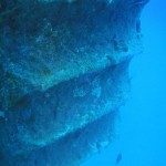
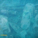
The wreck is slightly broken up in parts
The bow of the Imperial Eagle
Tony at the wheel
View of the bow from the superstructure
Broken railings
The wheel on the bridge
Tony swimming over the wreck
In 1995 she was sold to the local diving community, and was scuttled 500 metres off Qawra Point in 40 metres of water on 19 July 1999. The intention was that the vessel would form the main attraction in an underwater marine park. The vessel is colonised by large numbers of fish, who take shelter around it rather than trying to hide in the exposed, crystal clear waters around the ship.
Divers on the surface after dropping into the water
The propeller and rudder of our diveboat
The ladder for exiting the water
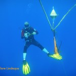
Tony next to the buoy line
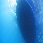
The underside of our dive boat
The visibility was almost top to bottom
Divers above us, doing their safety stop
Knot in the buoy line – not much growing here
Tony – neutrally buoyant
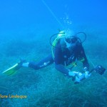
Tony passes over sea grass near the buoy line
We dived the Imperial Eagle off a traditional Maltese boat called a luzzu.Boat diving in Malta is done off a variety of vessels (basically, anything that floats!) but we were very charmed with the colourful hull and spacious accommodations of our boat for the day. Entry into the water was via a giant stride, and to exit one removes one’s fins and climbs up a small ladder on the side of the boat. The boat moves very slowly, and our surface interval was spent driving to L’Ahrax Point, location of our second dive that day.
A traditional Maltese boat, used as a dive boat
One side of the wreck
Saddle bream down the side of the wreck
Tony is surrounded by damselfish as he passes over the wreck
Saddle bream in motion
Saddle bream on the wreck
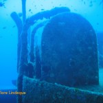
Storage compartments now open
The wreck is lightly encrusted
Funnel of the Imperial Eagle
The bow of the Imperial Eagle makes her appearance
There is a permanent buoy close to the wreck’s location, and on the way to the wreck one swims past the statue of Christ, located in a natural stone amphitheatre. The wreck is quite deep, and we did notice a distinct set of thermoclines as we descended. Since the coldest of these took us to a water temperature that is more or less the warmest we usually experience in Cape Town (and that usually coupled with Pronutro visibility), we weren’t fussed. Nitrox is an advantage on this site, and we used 32%. The wreck is of a very manageable size to see in a single dive, and is fairly intact but showing signs of her age.
On one of the days we spent diving in Malta we did two dives on the island of Gozo, accessible from Malta by using the car ferry at Cirkewwa. The diving on Gozo is wonderful, and there are dive centres located on this island even though only about ten percent of the 500,000-strong Maltese population resides here (the rest are on Malta, with four lonely souls on Comino). GozoDiver has more.
The entrance to the tunnel that leads to the open sea
Sign showing the layout of the Inland Sea and tunnel (excuse the large finger on top)
Algae growing inside the tunnel
The Inland Sea is a small, shallow (maximum 2 metres deep) body of water on Gozo at Dwejra Point, linked to the open sea by an 80 metre long tunnel through the rock. The Inland Sea itself is about 60 metres wide and is fringed by fishermen’s huts and a cafe or two. The tunnel is about 3 metres deep at its entrance on the Inland Sea, and drops to about 26 metres by the time it reaches the ocean.
The top of the wall, and the surface
Sergey checks that we’re still with him
Tony, Sergey and the Russians heading through the tunnel towards the sea
The vertical wall of the tunnel, and the surface
The light of the open sea appears at the end of the tunnel
The tunnel opens onto the sea
Tony’s light illuminates the wall of the tunnel
Large rocks on the tunnel floor, dislodged during storms
We emerge from the tunnel into the ocean
Sergey finning backwards along the wall
The wall outside the tunnel is overgrown with algae and seaweed
The wall drops off to 45-50 metres
Getting across (or through) the Inland Sea to the entrance of the tunnel was a bit uncomfortable – we entered the water next to a small jetty and put our fins on, but it was too shallow to swim and the rocks on the bottom were of an inconvenient size (like melons) and texture (slippery) for walking over. A slow backstroke punctuated by occasional ringing sounds as my tank struck a rock was the order of the day.
Divers heading out to sea
The tunnel and Inland Sea are used by pleasure boats which take tourists through the tunnel, and out into the ocean to see the Azure Window and surrounding coastline. While it’s an overhead environment in the sense that there’s a solid sheet of rock above one’s head, it’s possible to surface in the tunnel (provided one watches out for boats and stays near the sides). We descended at the entrance of the tunnel, straight into several metres of water. As we swam further into the tunnel the rocky bottom cleared to leave a sandy path down the middle of the tunnel. The tunnel slopes downward as one approaches the ocean.
A white tufted wom (Protula tubularia)
I found swimming through the tunnel to be an absolutely mind boggling experience. The blue of the open sea ahead is profound and draws one on through the darkness, and the warm water is incredibly comfortable. It was the kind of place where one can almost hear an imaginary soundtrack of some kind of celestial muzak. I felt that after having this experience I could die, happy. I also felt that this must be what heaven looks like (honestly – I could have stayed in that tunnel forever). But I didn’t die (of happiness) – the end of the tunnel brought us out onto a wall that dropped down to 50 or 60 metres.
Schooling salema fish
Sergey heads towards a school of salema fish
The wall drops to 50 metres in places
Tony and a cloud of damselfish on the wall
Distant Tony, and damselfish
Saddle bream, and disappearing divers
Saddle bream on the wall
Tony cruises along the wall
A fireworm (Hermodice carunculata) inside a cave
We took a long swim along the wall, at varying depths – we probably moved between 25 and 10 metres, following the contour of the outcrops and gullies. There were some weird horizontal thermoclines that manifested themselves visibly as well as through my wetsuit. Shimmering walls of water up ahead indicated a drop (often brief) in temperature. I’m not sure if these weren’t maybe spots where fresh water was seeping out into the sea through the limestone rocks.
Emerging from the vertical tunnel
Tony’s light illuminates the tunnel ahead of me
Swimming out of the tunnel
Tony moving over the sea grass outside the tunnel
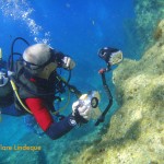
Just prior to this dive, Divemaster Sergey asked me in an offhand manner if I was claustrophobic. I replied in the negative, and thought nothing of it until he swam us through a 15 metre vertical tunnel in the rock, just wide enough to accommodate an average-sized diver. The tunnel opened up at about three metres’ depth, and a letterbox type arrangement allowed one to exit. I found this to be quite an intense experience, and was rather impressed with myself afterwards for swimming through the tunnel without batting an eyelid. I don’t have any cavern or cave training (and don’t actually think I want any – open water diving is fine for me!) but there was something wonderful about the caves and holes we swam into in Malta that helped me to understand the allure of overhead environments to braver folk than I (such as Cecil!).
Tony swims above me
We made our way back along the wall and into the tunnel, reversing our route to return to the Inland Sea. Just before the entrance to the Inland Sea we made a safety stop among huge blocks of limestone that have fallen from the ceiling of the tunnel. There was a lot of life here – colourful seaweeds, algae, corals and sponges, and some shy invertebrates who hid from Tony’s video light and my torch.
A fireworm inside the tunnel
There was quite a lot of swimming involved in this dive, and it was fairly demanding both physically and mentally. Obviously Sergey had decided what dive plan we’d follow based on what he’d learned of Tony’s and my air consumption and water skills in the five dives we’d already done under his guidance, and the options for routes and dive plans here are endless. Peter G. Lemon’s book on scuba diving in Malta lists a few of the options, and additional dive plans can be devised from the maps he provides.
Dive date: 4 August 2011
Air temperature: 32 degrees
Water temperature: 24 degrees
Maximum depth: 25.2 metres
Visibility: 35 metres
Dive duration: 53 minutes
Algae and invertebrate life inside the tunnel
Tony safety stopping near the end of the tunnel in the Inland Sea
The Inland Sea is ahead as we return through the tunnel
Large rocks have fallen from the tunnel’s roof to the seafloor
Rocks on the seafloor in the darkness of the tunnel
The tunnel joining the Inland Sea to the open ocean is full of beautiful plant life
The arch at Cirkewwa is located to the northwest of the lighthouse there, along the edge of the reef running along the coast. It is in fact a cavern whose roof is open (perhaps due to a long-ago collapse), with the arch across the entrance. The surrounding reef is covered with sea grass and posodonia beds.
The arch in the distance
Tony filming the arch
The midsection of the arch
Looking out from inside the roofless cavern
Algae, posodonia and sea grasses are abundant here
Cirkewwa arch
Bubbles and the arch
Bubbles rising through the porous limestone
Damselfish and rainbow wrasse among percolating bubbles
Bubbles on the reef
Rainbow wrasse looking for food among the algae beds
Damselfish (and a rainbow wrasse in the foreground)
Tony examining the top of the arch
Tony swimming along the top of the Cirkewwa arch
The drop off to deeper water makes for a lovely wall dive
The top of the arch is at a depth of about 12 metres, and the sand below is at about 20 metres’ depth. The rocks of which the Maltese islands are formed is mainly limestone, which is quite porous and has a tendency to form caves, holes and crevasses (all of which are enjoyed by divers). We loved watching the tiny bubbles coming through the rock – when divers swim under ledges and into caves, the air bubbles from their exhalations find their way straight through the rock.
Damselfish over the sea grass
Schools of fish on the reef
Entering the shallows, sunlight penetrates to a ridiculous degree
Tony investigates
On the left is a swim-through under an arch in the reef
Another natural arch in the limestone reef
The sea grass looks like seahorse country
Tony swims toward home in a cloud of bubbles
The damselfish enjoy edible items dislodged by rising bubbles
Bubbles, sea grass and damselfish
Bubble curtain rising through the limestone rock
Tony swimming along the edge of the reef
Tony checking out one of the many holes and swimthroughs on the reef
We only spent part of the dive at the arch, and the swim from the arch back to the exit point is extremely scenic. I’ve included a number of photographs of the reef, which is representative of all the reefs around Malta.
We found this tag from the University of Malta on the shallow part of the reef
The swim back to Susie’s Pool from the arch is quite long, and along a wall for most of the time. One can choose the depth to swim at – since the water is so clear, the only material consideration is air consumption. Under the wall are many overhangs, and there is rich plant growth and fish life from top to bottom.
Another mini-arch that we were able to swim through
Tony over beds of algae
The remains of some kind of bivalve attached to the reef
Tiny damselfish and a saddled bream
There is rich plant growth into quite deep water, owing to the clarity of the sea in Malta
Tony on the wall at Cirkewwa
A curtain of bubbles from divers below us
Approaching Susie’s pool, our exit point
Red mullet feeding in the shallows
The arch can be dived as a dive by itself (the depth and warm water allowing a long stay!) or, as we did, on the way back from a dive on the tugboat Rozi (hence the maximum depth shown below).
Dive date: 6 August 2011
Air temperature: 31 degrees
Water temperature: 20 degrees
Maximum depth: 34.0 metres
Visibility: 30 metres
Dive duration: 60 minutes
Divemaster Publio swims back to the entry/exit along the wall at Cirkewwa
The wreck of the Lusitania is considered by many Cape Town divers to be one of the top wreck dives of the region. It is fairly deep, the wreck is quite broken up, but still interesting, with a number of identifiable components, and the visibility is often quite good. However, it is a physically challenging dive, quite a distance from the launch sites, and conditions are not often suitable, so it is not dived very often. No doubt these factors add to the mystique.
Waves breaking over Bellows Rock
Tony and I had heard about the mystique surrounding this wreck, but because we hadn’t had an opportunity to dive it since he’s been in Cape Town (about two years now) we didn’t know much about it. Beautiful weather in the middle of winter provided an opportunity to take the long boat ride out of False Bay, past Cape Point, and further south to Bellows Rock. Bellows Rock is named for the way in which the water smashes over the top of it, and the break is apparently visible from Macassar – at the northern end of False Bay – when the swell is large.
The ship is now very broken up, after 100 years lying below Bellows Rock
Jumbled wreckage of the SS Lusitania
Wreckage lies tumbled among the smooth rocks
Great sheets of wreckage
Here and there are brass fittings and window frames
Railings (perhaps) from the SS Lusitania
Rocky reef on which the SS Lusitania is lying
A fish darts among pieces of the ship
The Lusitania was a large Portuguese liner that ran aground on Bellows Rock in late April 1911, carrying about 800 passengers. All but eight survived (a lifeboat capsized), and after a few days the ship slid down the side of Bellows Rock to where it now lies in 37 metres of water. A light Nitrox mix will help increase dive times here. She’s an old wreck – as old as the Clan Stuart – and very broken up. The wreckage is readily discernible, however, because it is not very encrusted with marine life at all. The surrounding reef, made up of granite boulders with a some nice holes, overhangs and places to look underneath, is very colourful and well encrusted with sponges. There are also massive numbers of West coast rock lobster!
West coast rock lobster
Sponges and soft corals at 35 metres
Colourful sponges and corals
Strawberry sea anemones on the SS Lusitania
Sponges and soft corals on the SS Lusitania wreck site
West coast rock lobster at Bellows Rock
Grant gave us a bone-chilling briefing that had me convinced (if one of the other divers on the boat hadn’t done it already by telling me with dewy eyes that this was “the Mount Everest of diving”) that this is quite a higher grade dive that requires wits, fitness and no small measure of courage for a scaredy-cat like me. The wreck lies right next to Bellows Rock, which is surrounded by a large area of breaking waves and white water. Descents at this site must be rapid – no messing around on the surface doing buddy checks (“PADI stuff”, as Grant called it once) – and descents are equally demanding. There’s usually a current pushing towards the north west, and this will force one onto the rock unless you take care. Grant advised us to swim gently in a north easterly direction (more or less across the current) as we ascended, and to do our safety stops at eight metres instead of the usual five. He warned us not to surface if we saw white water above us. He told us that he has “survived” being washed over Bellows Rock itself, but that it’s not an experience one wants to have unless it’s absolutely necessary.
West coast rock lobster
The ride out to Bellows Rock is magnificent, and takes about 20-25 minutes at the speed Grant drives (very fast). The sea was nice and flat inside False Bay, but outside the bay there was a small swell. Even though it was only 2-3 metres, Bellows Rock and surrounds looked like a terrifying whirlpool to me. Grant couldn’t drop a shot line onto the wreck because it would get washed over the rock (and presumably have to stay there forever, which would be an inconvenience). The plan was for us to enter the water in two groups. The first group kitted up, and Grant drove the boat as close as he dared to the white water around the rock, so that we were right over the wreck. He counted down, slowed the boat to a crawl, and the divers were gone. As soon as they rolled off he drove away so that the second group – me, Tony, Cecil and Ivan – could get ready.
Kitting up on the boat (that’s not us!)
Our entry probably looked just as scary, but I wasn’t actually looking at the water! Next time I do this dive I’d take more weight – for deep dives my preferred weighting is marginal and I have to swim down the first 3-5 metres; this wasn’t ideal for this dive, and because I was anxious about getting down quickly, I breathed too fast and struggled to sink! Once we were in, however, everything was fine.
What remains of the SS Lusitania
The Lusitania was a 5 557 ton vessel, very large. There are big, complete pieces of wreckage scattered about, but very little actual structure remains. Close to Bellows Rock – which drops off precipitously below the water line – are lots of interesting bits and pieces, but getting there and away is difficult because of the current. We spent some time exploring the edge of the wreck furthest from Bellows Rock, and then swam slightly north over some rocky reef that reminded me a lot of Klein Tafelberg Reef in Hout Bay.
Sponge on the wreck site
Our ascent was uneventful – we followed instructions, did a deep safety stop, and surfaced a safe distance from Bellows Rock. The water was very clean, and very cold, but as we moved further towards the entrance to False Bay the visibility declined somewhat. I’d like to dive this wreck again, but conditions have to be very special – with almost no swell and no wind – for it to be safe. I feel like a Philistine for admitting that the challenging nature of this dive was not compensated for by the specialness of the dive site itself, although it is without doubt a very interesting and varied dive.
A torch reveals the colours of the soft corals all over the site
The boat ride back past Cape Point and along the eastern shore of the Cape Point Nature Reserve was beautiful. We saw several whales, a sunfish (briefly), seabirds, and – for most of the trip – the ocean floor beneath us, as the water was crystal clear. It was, as Cecil said, an absolute treat and a wonderful way to spend a morning (all of it, even the death-defying leaps from a slow-moving boat!).
I’ve already published a post describing the history of the Rozi, and the technicalities (such as they are) of getting in and out when you want to dive the wreck. The adjacent dive site is the wreck of the P29, which lies closer to Susie’s Pool. The second time we dived her we eschewed the walkway (on entry, at least), and did a giant stride – very exciting – underneath the Cirkewwa lighthouse.
The lighthouse at Cirkewwa
Entry point for the Rozi at Cirkewwa
Swimming out along the wall to the Rozi
Divemaster Publio strikes out to sea
Tony swims towards the wreck of the Rozi
Approaching the stern of the Rozi
Moray eel in the shallow water on the way to Susie’s Pool after the dive
Tony and I were charmed by the age of the Rozi – she was built over 50 years ago – and that she is so intact. We have many wrecks in the Cape, but most of them are younger ships or far more broken up.
Bridge of the Rozi (from below)
Tony on the Rozi
Close up of the bumper on the bow of the Rozi
The bow of the Rozi
Funnel of the Rozi
Funnel, base of the mast and bridge of the Rozi
Tony inside the wheelhouse
Divemaster Sergey sitting on top of the bridge of the Rozi
Here’s another selection of pictures I took on the two dives we did on the Rozi. Our Divemaster for the second dive on the vessel (and the last dive of our 10 dive package) was a Maltese Instructor called Publio. We were delighted to meet a Maltese diver (and in fact fellow Maltese divers Stephanie and Joseph joined us for another dive we did that day). Publio and Tony had a good chat about the joys and woes of being a diving instructor, and it seems to be the same in Malta as it is in South Africa. If you want to know how that is, you’ll have to ask Tony!
Bridge of the Rozi
Tony swimming away from the wreck
Cable drum on the deck of the Rozi
Hatch in the deck
Wheelhouse of the Rozi
Tony in front of the funnel
Dive date: 6 August 2011
Air temperature: 31 degrees
Water temperature: 20 degrees
Maximum depth: 34.0 metres
Visibility: 30 metres
Dive duration: 60 minutes
Towards the stern of the Rozi, fender still in place
The curving hull of the Rozi
Bow of the Rozi
From some angles the Rozi looks as though it’s still a working ship
Winch drum on the Rozi
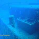
Storage compartments on the deck
Deck in front of the bridge
Looking up at the bridge, mast in the background
Bow of the Rozi
Rudder at the stern
Tony filming something in shallow water
Divers below us at Cirkewwa
Tony returns up the limestone wall at the end of the dive
The tugboat Rozi was built in Bristol, England in 1958. She was launched as Rossmore and a decade later was sold and renamed Rossgarth. In 1972 she was sold to Mifsud Brothers (Malta Ship Towage) Ltd. She thus sailed from Liverpool to Malta to be registered. In 1981 she was sold to Tug Malta and her name was changed to Rozi. She operated in the Grand Harbour, Valetta.
Mast of the Rozi, surrounded by fish
Looking up at the bridge of the Rozi
Heading towards the bow of the Rozi
Bream and damselfish pass in front of the funnel of the Rozi
Wheelhouse and base of the mast
The stern of the Rozi, with rudder
The stern of the Rozi
Looking down the port side of the Rozi towards the bow
The mast is located behind the bridge
The bow of the Rozi from above
Doors and windows have been removed to facilitate penetration of the wheelhouse
In 1992 she was sold to Captain Morgan Cruises, the ubiquitous (at least in Malta) party boat and adventure company, and was scuttled off the northwest of Malta at Cirkewwa, where the car ferries travelling to and from Gozo dock. She was placed there as an attraction for tourists visiting the area in a small tourist submarine (with windows, obviously).
The stern of the Rozi
The beautiful Rozi is now lying intact except for her engines and propeller. She lies upright in about 34 metres of water. Nearby lies the wreck of the patrol boat called P29.
Tony behind the rudder of the Rozi
Tony swims away from the stern
The wreck is very intact with railings, winch drums and walkways still present
Near the stern you can drop inside the wreck (big thermocline!) – to the left in this photo
The funnel of the Rozi
The starboard side of the Rozi disappears into the blue
View from the bow of the Rozi
Start of a walkway down the port side of the Rozi
A fish watches Tony in the wheelhouse
Tony investigates inside the funnel
Tony swims away from the wreck (reluctantly)
Black sea bream (Spondylisoma cantharus) in front of two banded sea bream and saddle bream on the Rozi
There is a large car park specially for divers, where many branded vehicles filled with cylinders, wetsuits and other dive gear can be seen on a daily basis. To get in, we walked down a sloping walkway with a handrail. At the bottom of the walkway we donned our fins and stepped into Suzie’s Pool, a shallow (waist deep) area that leads out into the sea.
Tony entering the water
Entry point for the Rozi and P29 – Susie’s Pool
Walkway down to Susie’s Pool
Shallow limestone reef outside Susie’s Pool
Swimming off towards the wreck
This sand spit is the indication to turn offshore when navigating to the wreck
Approaching the wreck
Moray eel on the Rozi
Swimming into Susie’s Pool and towards the exit point
Tony climbing out of the water (behind a water droplet)
The view down the port side of the Rozi
As with all artificial reefs, the Rozi is rich with fish life. Tony and I always wonder how the fish manage to find the scuttled ships afterwards, but somehow they do!
During my stay in Jordan, (diving for Dive Aqaba) we often dived the Cedar Pride. She is a Lebanese cargo ship that was scuttled in 1985 after lying in the port for three years, abandoned by her owners after a fire in the engine room in 1982. The ship was sunk as an artificial reef and lies on her port side. The beauty of this dive site is that the depth on the starboard side is around 10 metres, yet the sand below the port side is around 28 metres.
She lies on a rock formation allowing for a swim through up near the bow. Wreck penetration is also an option for all levels as you can swim through a few hatches or go all the way into the engine room. The ship is 75 metres long and you can explore all of the deck area and several open holds and this wreck is home to a huge variety of marine life. At approximately 150 metres off the beach it is possible to do this dive as a shore entry but it is far better doing a boat dive as there is also a barge and a small fishing vessel close by. The wreck has a permanent buoy and the viz is almost always 25 metres. There is a high speed ferry that runs into Aqaba daily from Egypt and the surge created by this ferry causes the Cedar Pride to rock slightly and if you are near the prop at the time you can see the keel lifting ever so slightly.
Not far from the wreck of the tugboat Rozi, off Cirkewwa in Malta, is situated a huge anchor, lying on the sand. It’s quite encrusted with sea plants and is an arresting site for passing divers.
The anchor is over two metres longSwimming over the anchor
The dive details shown below are from a dive we did on the Rozi (our first dive in Malta, in fact), after which we visited the anchor on our way back to shore.
After some years in the sea the anchor is quite encrusted
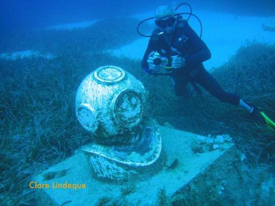
The Atlam Sub Aqua Club (Atlam is Malta spelled backwards) put this commemorative plaque and statue of an old fashioned diver’s helmet up in 2005 to celebrate their 50th anniversary. It’s located in about 28 metres of water on the way to the Um El Faroud off Weid iz Zurrieq in Malta, one of the most magnificent wreck dives in the Mediterranean, and as such provides a useful navigational aide.
The statue is a navigational aid to finding the Um El Faroud shipwreck
While we’re on the subject of diving helmets, here are two more that we found on our travels…
Signage outside a Danish firm of commercial divers
Tiny model of a diving helmet at Subway Scuba, Malta
The helmet rests on a plinth, raising it off the seabed
The dive details below are for the dive on the Um El Faroud during which we visited the plaque.
The statue depicts an old fashioned diving helmet
Dive date: 5 August 2011
Air temperature: 31 degrees
Water temperature: 22 degrees
Maximum depth: 34.3 metres
Visibility: 20 metres
Dive duration: 49 minutes
Six years of encrustation does not amount to much in these watersTony behind the monument
Diving in Cape Town is often done without a Divemaster. Many of the dive sites are shore entries and quite often they are dived by casual divers and groups of friends.
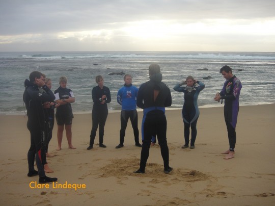
Dive briefing on the beach at Sodwana
Resort environments most often only conduct led dives, meaning there is a Divemaster that knows the site, the local conditions and the wildlife you will most likely encounter. These dives will invariably start with a dive briefing where the site will often be drawn on the sand or displayed in a book. The Divemaster will detail the site, the dive time, what percentage of you air will mean that you are “low on air” (often based on the depth, conditions and skills of the group), who leads, who follows and who buddies up with whom. Dive time and profile will also probably be based on the Divemaster’s computer. A good briefing will also cover lost buddy procedure, what to do in an emergency and the hand signals that will be used. Entry and exit techniques or special requirements will also feature. Some briefings will also include the signals for specific creatures.
In essence a dive briefing should cover as much as possible is a relatively short time (10 minute briefings will bore any diver to death) unless you are planning a very technical or potentially hazardous dive. The more you cover in a briefing the less chance of confusion underwater.
Diving, irrespective of the location is best conducted in a safe manner. (You get to do a lot more dives that way!) Understanding the weather, assessing the conditions and having some knowledge of the site goes a long way to ensure a good dive. Diving within your own ability also rates highly.
Cape Town offers the qualified diver a wide range of dives and the fact that there might not be a Divemaster with you does not mean you should not experience the dives. There are a few basics to consider, knowing the dive site is only possible after you have dived it a few times. Once you have decided to dive a site, read all the available information on the wikivoyage site for diving in Cape Town. This website will be your Divemaster. It will tell you how to get in and out, what skills and qualifications you need, depth, and the marine life to be expected. It will also tell you which weather conditions are best for the site. Pay close attention to the bearings if you want to see a specific feature, and know what the bearing is to get you back to shore.
Armed with all of this knowledge you and your buddy/buddies need only agree on a few issues before you set off. Plan your dive and dive your plan. If you agree it will be a 40 minute dive, stick to that. If you decide on who will lead then keep the order as such. Who your buddy will be and depth are important and it is important to agree on signals. As a qualified diver you are responsible for your own air so you need not have a Divemaster check it for you. If you are a group that dive together often then its best to base the dive time on the member with the worst air consumption, unless they are happy to return to shore alone. You will need a compass, and you will need to read the site details together to ensure you all have a good idea of the environment and likely conditions. You must have an SMB as this avoids the potential haircut you can receive from a passing boat.
It should not be required to cover this but I will ANYWAY, Make sure your equipment is proper, the correct size, and in serviceable condition. Don’t enter the water if you have an equipment malfunction or a leak or any other issue. Don’t think “we won’t be deep,” or “we won’t be far from the shore” and dive with faulty equipment. Should an emergency arise and you are swept out to sea, that small leak on you BCD will soon be a huge problem.
Diving is a very safe sport if you follow the rules, do the checks, and dive within your training. Do these things and you will have thousands of dives, each one often better that the last one.


")


")


")