Fooling around with cameras (and phones) is our second calling. We joined Instagram recently and are enjoying sharing pictures of our adventures, and viewing beautiful images from around the world. You can find us here! Please let us know if you’re an instagrammer – we’d love to follow you.
If you turn slightly to the right from where I took this photo, you’ll see this view, or this one. I was standing on Contour Way at the top of Fish Hoek. Somewhere far in the distance, is our house.
Tony and I drove up to the top of Fish Hoek, to see what the Shark Spotter can see from his hut at the end of Contour Way. This photo was taken from further down the road, lower down than the hut. Wherever you stand, you can see a lot! It was windy and swelly when I took this picture, but you can still see the kelp and rock patches close to the catwalk without the aid of binoculars.
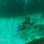
Here’s Tony at the safety stop in a notable plankton bloom, at the end of a dive at Justin’s Caves. Fortunately the water was clean at the bottom, and even cleaner inshore on the landward side of the rocks!
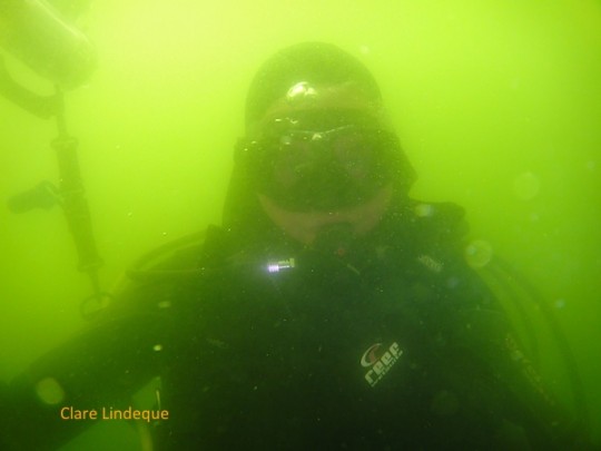
A strong south easterly wind that brings clear, nutrient rich water from deep offshore, followed by even a few windless hours of sunshine, will turn the surface waters of the sea on the Atlantic side of the Cape Peninsula to pea soup. Here’s a salutary example from a dive we did where the top 20 metres or so were thick, green sludge.
Sea Dog is a surfski time trial at Fish Hoek beach that takes place every Friday evening, starting at six in the evening. It runs for the last ten weeks of the year, and the first ten weeks (so twenty weeks, during the summer months). There is a gap in between for Christmas and New Year. It has been running for a few years, and a meet is never cancelled for any reason. We can attest to this, having gone down to the beach during a black south easter with bucketing rain, only to see a hardy group of paddlers battling it out behind the breakers in almost zero visibility.
The event is organised by the Mockes of the paddling shop in Fish Hoek, and there’s usually a photographer (apart from me) to document the event. There are usually a couple of marker buoys out in the bay, and the paddlers do a number of laps around them. I’m not sure of the details of the race format, but it starts and ends on the beach. There are participants of all skill levels, from world champions to weekend warriors.
The course ended about here
Lots of action in the middle
Colourful shirts on a turquoise sea
Paddlers in front of the catwalk
Heading towards Clovelly
Rounding the buoy at the eastern extreme of the course
If you’re around, it’s a lovely thing to watch (or participate in, if you’re a paddler) on a Friday evening after work. We sometimes get dinner and take it down to the beach to watch the proceedings.
I’m not sure why I haven’t written about Roman Rock before. I’ve actually done four dives on the main reef, the first in 2010. The pictures in this post are from more than one of the dives – I’ll group them together, and you’ll be able to see by the water colour which dive is which.
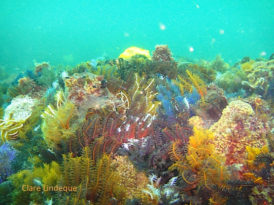
Part of the dive is along high walls that are reminiscent of Atlantis Reef, further south. There are deep dead-end passages in between the rocks, wide enough to swim through (or drive a car through), and the rippled sand looks like a white carpet or a runway. In the middle of nowhere you will come across a ladder; it’s been there since the first time I dived Roman Rock in 2010. Your guess is as good as mine.
Ladder in the middle of nowhere
Sand runway
Craig looks into a gully
Fish in a gully
Looking towards the top of the reef
Craig with the buoy line
Redbait at Roman Rock
The site is suitable for Open Water divers, as the maximum depth one can attain while staying adjacent to the reef is about 18 metres. There are several pinnacles and shallower plateaus that are suitable for deeper safety stops. It goes without saying that each diver must have a surface marker buoy – the site is a relatively short boat ride from False Bay Yacht Club, but offshore nonetheless and there may be boat traffic, depending on where the current takes you.
I took this photo with Tony’s long lens, from the parking area of False Bay Yacht Club, which is a good place to see the waterfall when it’s in flood. It was one day after we’d had 120 millimetres of rain in under 18 hours, so there was a lot of water coming off the mountain. If you want to see the waterfall up close, drive your car to the end of Barnard Street in Simon’s Town, and walk from there. It’s a flat walk of about twenty minutes.