Be a marine citizen scientist (slash conservationist) in Cape Town

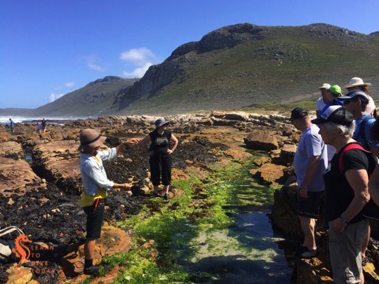
Here are a few ways for Capetonians to save the ocean. Some through direct action, and others through support for scientific research that enables policy makers and conservationists to make good decisions about which species and habitats need protection.

I’ll update this list as new projects are brought to my attention. If you know of an opportunity for ordinary citizens to make a difference for marine science and/or conservation, let me know and I’ll add it here.

Dolphin species distribution

Sea Search would like to map dolphin distribution with the help of citizen scientists (you), partly in order to anticipate what changes may occur in response to climate change. All you need to do is report dolphin sightings and a bit of supporting information via their facebook profile, twitter handle, or iSpot project page. You can read more about their research project here.

Sevengill cowshark sightings

This cowshark appears to have been tagged

The Spot the Sevengill Shark project has a facebook page where you can submit images of broadnose sevengill cowsharks taken in False Bay and surrounds. The unique markings on these sharks enable repeat identification from well-composed images. Information about the sex, general appearance and behaviour of these sharks is also useful. There’s some information about the research project here. This is also a great project to follow (on facebook) to keep up to date with the tagging studies that are currently being done on this population of sharks.

For a more global flavour, you can check out the Sevengill Shark Identification Project. It operates mostly in the San Diego area in the USA, but accepts sevengill cowshark sightings from locations around the world, including from South Africa. Their facebook page recently celebrated the first logged sighting from False Bay.

Great white sharks

If you spot a great white shark – while diving, paddling, swimming or surfing for example – please report it to Shark Spotters! This enables the general public to be alerted if necessary, and also provides valuable data for research about white sharks in False Bay and around the peninsula.

You can either report the sighting via the Shark Spotters website, or you can call or text +27 (0) 78 174 4244. Provide as much information as possible, obviously including the location where you saw the shark, and when. If you have a photo or video, that’s a bonus!

Sharks and rays

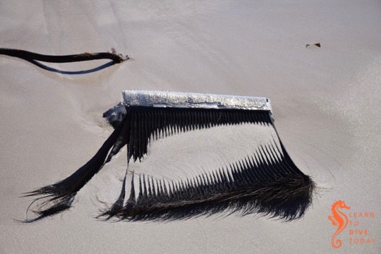
The ELMO (South African Elasmobranch Monitoring) project collects reports of elasmobranch (shark and ray) sightings along the South African coastline. For the avid beachcomber, their database includes egg cases. The data collected is available to any interested party for their own projects, and can assist conservationists and politicians to make good decisions in order to protect species that need it.

The ELMO website is full of excellent information, including identification guides for egg cases and elasmobranchs, and a handling guide for live animals (aimed at fishermen, not people who are grabby – don’t be like that). You can submit your sightings online.

You can also find ELMO on facebook and twitter.

iSpot

Upload photographs of the marine species you see to the iSpot, SAJellyWatch, or one of the Avian Demography Unit’s project pages. These observations are a help to researchers tracking species distribution – for example, as part of climate change and invasive species research.

More information can be found here.

 Poaching

If you see marine poaching activity in progress, please call to report it. The phone numbers you will need can be found here.

A humpback whale on the beach

Humpback whale on the beach

Last year the carcass of a smallish – about 8 metre long – humpback whale (Megaptera novaeangliae) washed up on one of the less-frequented beaches around the Cape Peninsula. I am very belatedly sharing some pictures of it, not least because one doesn’t often get an opportunity to examine an animal like this up close. I view these things with a mixture of sadness and awe; I think it’s easier to process objectively when the animal has already died. Strandings of live cetaceans can be extremely distressing.

Baleen plates
Baleen plates

Some pieces of the whale’s baleen, which these animals use to filter their food from the water, were lying nearby on the beach. A large group of whales had been passing by the Atlantic seaboard in the days preceding the carcass washing up, and it may have been one of them.

The whale had been dead for a few days by the time it washed up on shore, but not so long that a lot of its skin had sloughed off (sometimes dead whales look white all over – as this whale’s belly does – for this reason). There was no obvious cause of death visible on the underside of the whale’s body. It was lying upside down so the top of its body wasn’t accessible.

It is possible that an anthropogenic cause (ingesting plastic, or a ship strike for example) could be responsible for this whale’s death. It’s also possible that the whale was sick or otherwise compromised and died of natural causes. Sometimes, when things in the ocean die, they wash ashore, and we find them.

I’m not sure what ultimately happened to the whale’s remains – it was in the surf line when I saw it, being pushed back and forth by the waves. It might have been taken back out to sea with the tide. I would like to think that it was.

If you come across a dead whale – on the beach or out at sea – here’s what to do.

Whale carcass reporting in Cape Town

Whale skull near the Thomas T Tucker

The Environmental Resource Management Department at the City of Cape Town needs your help:

We would like to try and get to whale carcasses well before they wash ashore on our coastline to deal with them more effectively and efficiently. As ocean users, if you come across a whale carcass floating anywhere in False Bay or from Cape Point north to Silwerstroom Strand we would be most grateful if you could call, whatsapp or sms 083 940 8143 (available 24/7) with an approximate location and time of sighting.

Please could I ask that you also forward/share this email to as many friends, colleagues or groups that you are aware of that use the ocean as we would like as large a network of people as possible that could report sightings.

Save that number in your cellphone contacts, and do your bit for beach safety and, hopefully, for the environment, by reporting sightings of deceased whales before they reach the beach.

Ideally (environmentally speaking) dead whales should be left out at sea to be scavenged upon by marine life and then sink to the bottom and return their nutrients to the ecosystem. Unfortunately the prevailing summer wind direction in Cape Town (south easterly) generally brings any such carcasses onto the beach in False Bay. This is a hazard to human safety because of the co-incident inshore presence of great white sharks during the summer months. A dead whale is a great feeding opportunity for sharks, and its accompanying oil slick will be evident from miles away, potentially bringing in more sharks to investigate. This is why the City wants the opportunity to deal with whale carcasses before they reach your local swimming beach.

It’s timely to remember that while some cetaceans die and end up on the beach because of reasons such as ship strikes, ingesting plastic or other pollutants, or acoustic disturbances related to human activity, some of these animals also die of natural causes or illness unrelated to man’s impact on earth. Many times, scientists will examine the dead animal and be able to state what most likely led to its demise. While it is distressing to see any dead animal, and particularly strange and discomfiting to see a whale on shore, this is not necessarily confirmation that “the ocean is dying” or that we are “killing False Bay.” Sometimes it’s just the circle of life. Dead whales were an important source of nutrients and building materials to Strandloper communities long before industrial shipping plied the world’s seas.

For more on what happens to whales that die at sea (hint: it’s magnificent), check out this video. For more on the collision of dead whales and the urban environment, there’s this post about a whale on the beach in Fish Hoek, this one about a whale on the road in Cape Town, and this one about a stranded whale in the United States.

But I digress. Save this phone number: 083 940 8143, and tell your ocean-loving paddler, surfer, sailor, boater and diver friends to do the same!

Coastal foraging part II: the feast

The various edible seaweeds that we foraged

After foraging on the sea shore for edible seaweeds and mussels under the guidance of Roushanna and Gael from Good Hope Gardens, we returned to Gael’s house in Scarborough to prepare a meal with our finds. The group divided into four, and we worked together to prepare the food using recipes provided by Roushanna.

Decorating the sushi rolls

Sushi rice mixed with finely chopped sea lettuce (Ulva spp) formed the base of vegetarian sushi rolls, which were decorated with kelp, tongue weed, radishes, avocado, mayonnaise, and a secret sauce (recipe for the rolls here). Sea lettuce was also the seaweed of choice for a couscous and rocket salad, decorated with hibiscus flowers and miniature tomatoes (recipe for the salad here).

I worked on the coleslaw, made from finely sliced red cabbage, carrots, and hanging wrack (Brassicophycus brassicaeformis) – a seaweed I found so tasty and crunchy I could have sat right there in a rock pool and eaten it directly off the rocks. The mussels were picked over, scrubbed, and prepared with white wine, cream, onion, and garlic. Crusty ciabatta soaked up the sauce. Once we were done, it looked as though we had enough mussel shells for our own personal shell midden!

Rinsing and scrubbing the mussels

Roushanna prepared nori (purple laver, Porphyra capensis) crips for us (like kale chips, but with a crispier texture and more flavour), and chocolate nori ice cream for dessert. We supplied our own drinks. During breaks in the lunch preparation some of the group enjoyed a face (and hand) mask made from seaweed ingredients. Others of Roushanna’s recipes you can explore for yourself are for sea biscuits (scones made with sea lettuce), fruity vegan jelly, and kelp and avo salad.

Lunch was a collaboration, and a tasty culinary adventure. I found it marvelous to discover what is available on the sea shore, and to get a small hint of how our strandloper ancestors foraged on the Cape Peninsula.

Preparing our foraged lunch

(Puzzled what this is all about? Read my first post about coastal foraging here.)

Coastal foraging part I: the forage

Roushanna educates us about foraging for seaweed

A chance conversation with a friend who also volunteers at the Two Oceans Aquarium led to me enrolling in a coastal foraging course with Roushanna and Gael Gray from Good Hope Gardens, the nursery between Scarborough and Cape Point. Their coastal foraging courses are run during the summer months (I went in December), on dates close to spring tide, so that the maximum possible area of shoreline is available to forage on. The course takes the form of a rock pool expedition on Scarborough beach, followed by lunch – prepared by the participants – at Gael’s beach cottage.

Foraging for edible seaweed

As I get older I am finding it increasingly difficult to suppress a wildly eccentric streak that frequently finds me – consciously or unconsciously – making small preparations for some kind of apocalypse (zombie or otherwise). This might be related to living on the South African roller coaster for too long, but whatever the origin of this latent anxiety, it has served to make our home life more sustainable and – little bit by little bit – more independent of the electricity grid, the municipal water system, and grocery stores. The idea of coastal foraging dovetails nicely with my desire to learn how to live a little bit more off the land than off the shelves at Woolworths!

Mollusk permit inspection by fisheries officials

It is important to respect some simple rules to ensure that your foraging is sustainable, safe, kind to the environment, and legal. Each of us had purchased a mollusk permit allowing us to harvest mussels, obtainable from the post office (available for R94 using the same form as the scuba diving in marine protected areas permit), and these were inspected by fisheries officials quite early on in our forage. You don’t need a permit to harvest seaweed (however if you wanted to do it on an industrial scale you might need to go through official channels).

There are three types of mussels found on South Africa shores: the ribbed mussel and black mussel are indigenous, and the Mediterranean mussel is introduced. Unfortunately Mediterranean mussels out-compete the indigenous varieties, and we only saw one or two black mussels while we were out. The mussels we harvested were the Mediterranean variety, distinguishable from black mussels by the thick, flat edge to their shells. Black mussels have pointy edges all around their shells, making them more streamlined.

Mediterranean mussel (left) and black mussel (right)

There is only one type of seaweed growing along our coast that is harmful to eat (acid weed – Desmarestia firma, which has sulphuric acid in its fronds). This brown algae species does not grow on the rocky shore but only further out in the surf zone. This gives rise to the simple rule of only harvesting seaweed that is growing on the rocks, and never collecting seaweed that is floating free.

When harvesting seaweed, we used a pair of scissors to avoid pulling the entire plant off the rocks, and cut no more than a third of the leaves. Seaweed is full of vitamins and minerals, particularly iodine and potassium. It isn’t something you’d make a whole meal of, but it is a healthful addition to many dishes and – once you know how to prepare it – tastes pretty good!

Clouds at Scarborough

You can read more about the Good Hope Gardens coastal foraging experience here and here. Watch this space for more about what we prepared with our seaweed spoils…

Colour fronts in False Bay

Colour front seen from Sunny Cove on 27 November 2015

Perhaps you have wondered what causes the patterns of strange coloured water in False Bay during the summer months. Perhaps you have dived in it, and wondered why sometimes you can’t see your hand in front of your face! Wonder no more – I am here to help.

Colour fronts

Frequent visitors to and residents of the shores of False Bay will observe that at certain times of the year, the ocean is marked by bands and arcs of sharply contrasting coloured water. This phenomenon is known as a colour front. In oceanography, a front is the interface or boundary between two separate masses of water. In this case, the water masses are easy to discern, because they are of different colours. There are usually other characteristics of the water on each side of the front that differ, too. Fronts are either convergent (the water masses are moving towards each other) or divergent. The presence of marine debris (like pieces of kelp) at the front boundary suggests that it is convergent.

Causes of colour fronts in False Bay

Prior to 2005, there was much conjecture about the causes of these fronts (including the usual pollution bugbear), but little evidence to support any of the theories. By sampling, the fronts were found not to be caused by pollution, or by plankton blooms in the surf zone. It was known that a colour front was most likely to occur in False Bay after a period of southerly or south easterly wind lasting a few days. October and November seem to be prime months for the phenomenon.

When a large, obvious colour front arose near Simon’s Town in November 2005 with milky green water on one side, and darker blue-green water on the other, researchers from UCT and IMT sprang into action, sampling the water on each side of the boundary so that they could measure its characteristics. Speed is of the essence in these situations; colour fronts can disappear quickly. The one in the picture below is busy decaying – notice the smudged boundary.

Colour front in north western False Bay on 13 November 2014

Measurements revealed that the milky green water overlaid the clearer, bluer water, down to a depth of 11-12 metres (this will vary from front to front). The milky water did not extend to the ocean floor.  Scuba divers around the Cape Peninsula will be familiar with the experience of diving through two or more layers of water, with varying turbidity (clarity) and temperature! (Here is picture of Tony and Christo diving near Oudekraal in the Atlantic that shows what the boundary between two layers of water can look like.)

The researchers found that the milky coloured greenish water was full of fine, almost neutrally buoyant particles of calcium-rich sediment. The green-blue water contained much less calcium, but relatively more silicon, which would suggest the presence of diatoms (a kind of phytoplankton – you can think of them as teeny tiny plant-like organisms) or sand in the water. The origins of the calcium-enriched sediment in the milky water are interesting: one source is from the shallows (less than 30 metres deep) of north western corner of False Bay, where the ocean floor is made up of rocks that are rich in calcium carbonate (such calcrete and limestone), some areas covered by a thin layer of sand.

Milky-white water near Swartklip on 29 November 2014

The second probable origin for the particles of calcium-rich material is the interface between the sea and the land at the northern end of False Bay. The cliffs at Wolfgat/Swartklip at the head of the bay are made of calcrete, and at Swartklip the beach narrows to the extent that the cliffs erode directly into the water when the sea is high. Strong southerly winds create a wide (of the order of one kilometre) surf zone at Muizenberg and Strandfontein; a spring tide also adds to ideal conditions for the generation of a colour front.

The temperature of the milky water was found to be slightly (0.4 degrees Celcius) higher than the green-blue water. This measurement will also vary from front to front. The researchers speculate that the temperature difference could be because the milky water originated in the surf zone, which is shallower and therefore warmer, or because the high concentration of suspended particles in the milky water caused greater absorption of heat from the sun.

Colour front at Smitswinkel Bay on 24 October 2014

Summary

Here’s the tl;dr: strong southerly and/or south easterly winds, perhaps coupled with spring tide conditions, set up a very wide surf zone along the northern end of False Bay, which disturbs the sediment on the ocean bottom and drives the waves further up the beach than usual. Particles of buoyant calcium carbonate from the sea floor and eroded from the cliffs at Swartklip are lifted up into the water column, changing its colour to a milky-green shade. Wind-driven circulation patterns in the bay push the front from its original location in a southerly direction, towards Simon’s Town.

What to do?

Contrary to what your friends on social media may claim, not all colour changes in the ocean around Cape Town can be attributed to a giant sewerage plume. Hardly any of them can, in fact. In summer, the reason for the ocean looking green, red or even brown is likely to do with a plankton bloom of some description, or related to suspended sediments (as in this case) or other naturally arising material in the water. Instead of using this as an opportunity to become hysterical on the internet, how about celebrating the incredibly dynamic system that we can observe, living near the ocean? Drive up a mountain next to the ocean and take in the spectacle from on high. Dip your face in the water and see what it does to the viz. Take some pictures for posterity. And – if you don’t know what’s causing it – try to find and question someone who does know, like a scientist, or consult a good non-fiction book, to find out some facts.

If you’d like to read more about colour fronts in False Bay, take a look at this scientific paper (pdf), which I used as source material for most of this post. The paper is called A Prominent Colour Front in False Bay: Cross-frontal structure, composition and origin

Sea life: Southern elephant seals

Elephant seal busy moulting

A juvenile southern elephant seal (Mirounga leonina) has been seen around the Cape Peninsula for a couple of months. Almost every year solitary individuals are spotted resting on our shores, but they remain uncommon visitors and always cause a bit of excitement. Their usual habitat is subantarctic and Antarctic waters, including the islands belonging to South Africa and New Zealand, the Falkland Islands, and select parts of continental South America. They feed in Antarctic waters and spend winter down by the pack ice, insulated by tremendous layers of blubber. They are expert divers and can hold their breaths for two hours at a stretch.

Elephant seal cooling off with damp sand

Southern elephant seals are the largest seals, with the males (which can weigh up to 4,000 kilograms and grow to six metres in length) as much as six times larger than the females, which weigh 400-900 kilograms and grow to between 2.5 and 3 metres in length. At sexual maturity the males develop a big, inflatable rubbery snout (more correctly called a proboscis). This gives them their name, thanks to its rudimentary resemblance to an elephant’s trunk.

Juvenile seals are weaned and leave their mothers when they weigh about 120 kilograms. At this point they are just under a month old. This particular seal, which we saw hauled out near Cape Point, was at least two metres long already, and was busy moulting. During this time, the seal loses (as you can see in the top image) and regrows its fur. Some of its blood supply is diverted towards its skin to facilitate hair growth. Moulting happens during summer, and takes about a month (because it happens so suddenly, it is called a “catastrophic moult”). During this time the seals stay out of the water and possibly do not eat. Lying on the beach, well insulated with blubber, can cause them to overheat, so the seal we saw was flicking damp sand over his (or her) back to cool down.

As far as their conservation status goes, they are listed as of least concern on the IUCN Red List. They are probably helped by living so far from human activity, although they are still affected by plastic pollution, boat strikes and the like.

If you do see one of these animals, don’t be a jerk. Keep your distance (at least 20 metres) and don’t completely surround the seal. This ensures the animal stays happy and calm, and sets an example for others who may not have your good attitude, excellent education and experience with animals. Also, seals can move surprisingly fast on land, and an elephant seal is almost certainly going to weigh a lot more than you do. Tony took these pictures from a respectful distance, with his 150-500 zoom lens.

The Phyllisia circuit at Cape Point

Some time ago I promised to describe the route we took in the Cape Point Nature Reserve to locate the wreck of the Phyllisia, a small fishing trawler wrecked in 1968 and one of the visible shipwrecks around the Cape Peninsula. Here’s that post!

The view from the start of the trail at Gifkommetjie

Tami, Maria and I set out on a slightly drizzly, grey morning from the Gifkommetjie parking area inside the reserve. The first part of the walk was a steep descent down to the beach at Gifkommetjie, where we admired some fishing debris. From there, the trail meanders north, parallel to the coast. Most of the path is sandy, but other parts are rocky and hard-packed.

There are natural tunnels formed by the overgrowing milkwood trees, requiring a bit of ducking and crouching to go through. The feeling of being in a forest and yet right by the ocean is lovely. After about 2.5 kilometres – the path gradually bends inland – one reaches a T-junction, with an unambiguous sign saying SHIPWRECK, pointing left. If you want to see the Phyllisia, or just get closer to the coast, take that path!

Turn-off for the Phyllisia

It’s another few hundred metres across unclear paths over the dunes to Hoek van Bobbejaan, a promontory with a beach to the north of it (pictured below) that really shows the wildness of this stretch of coast, and how exposed it is to the open ocean. The Phyllisia is right on the outermost point of Hoek van Bobbejaan, and is the same colour as the rocks it’s lying on, so you might need to look carefully!

The beach at Hoek van Bobbejaan

Just above the wreck is one of the (I think) large okoume logs that fell off a ship in Table Bay in 2008 – more on that in this post about the Shipwreck Trail. It’s a great spot to take stock of your surroundings, and a vantage point for photos, as Maria demonstrates below!

Tami and Maria on the log at Hoek van Bobbejaan

To return, follow the path back towards the T junction and keep going straight. The path forks again – the left fork will take you towards Brightwater, and is part of the overnight Cape Point trail. Take the right fork – you should start climbing the rocky ridge that you’ve been walking alongside, towards the level of the parking area.

The return route is along the top of the ridge, along paths that we sometimes struggled to find because the vegetation had been burned away. Upright sticks with red and yellow paint on the end provided some guidance at intervals. The views down over the path you’ve just walked, and back towards Hoek van Bobbejaan, are spectacular.

You can of course, also return the way you came, and do a short, sharp climb at the end back to the parking area, or do the entire walk back and forth along the ridge, skipping the milkwood tunnels, and descend to the shipwreck half way through the route.

We saw bontebok, ostrich, baboons, an angulate tortoise, and wonderful spring flowers in the dunes and on the mountain. The walk took us about three hours at a slow pace, with a regular photo stops. As always, if you go hiking, go in a group (four really is ideal), wear appropriate shoes and a hat, apply sunscreen take waterproof or windproof clothing even if the weather looks nice, bring water to drink, stay on the path, and tell someone where you’re going and when to expect you back.

If you’re interested in visible shipwrecks, check out my ebook Cape Town’s Visible Shipwrecks: A Guide for Explorers!

Visible shipwrecks: SS Kadie

The Kadie on the beach, further parts of the wreck in the rockpools

The mouth of the Breede River is a fascinating and beautiful location. There’s a treacherous sandbar (more on that just now). There are wide, natural vistas. There are sleepy holiday villages on each side of the river mouth. There’s an additional little frisson of excitement related to the fact that bull sharks use the Breede River, and must be passing by all the time (right?!).

When Tony and I were in the area for a spring break, we explored the area. I wanted to see whether I could find the remains of SS Kadie, a steaam-assisted sailing ship that is an integral part of the history of the area. The Kadie was built in Scotland in 1859, for the specific purpose of navigating the Breede River and up and down the coast, as a trading vessel. She did venture out to sea on longer voyages, on one occasion carrying a cargo of ostriches to Mauritius. (You can read a lot more about her history, and that of the Barry family who operated her, here.)

On 17 December 1865 the Kadie ran aground and sank while attempting to cross the sandbar at the mouth of the Breede River. She is easy to find, but you should visit at low tide. Take the turnoff to the river mouth from the dirt road to Infanta. It’s a small sign and easy to miss! Descend the wooden staircase onto the beach, and walk right. You will soon see pieces of the Kadie on the beach, in the shallow rockpools, and out in the surf zone. Best to go at low tide, or at least not at the peak of high tide.

Looking down the beach to the Kadie

If you’re interested in visible shipwrecks, check out my ebook Cape Town’s Visible Shipwrecks: A Guide for Explorers!

Playing with a dog at Struisbaai

The little dog at Struisbaai

One of the locals in Struisbaai has a small, black dog that was playing at the harbour when we were exploring (and filming stingrays). The activity of choice was retrieving pebbles from the small shore break, with a small breath-hold as required, and then vigorously burying them in the sand higher up the beach. Passers by were encouraged to participate in the game, which is how we got involved – the harbour was quiet that day and we could not resist her wagging tail and persistent barking at the end of the jetty. I think this little dog would get on well with Dori from Ponta do Ouro

Tony filming the dog fetching a stone
Filming the dog fetching a stone

Here’s a small video I took of the dog and her game:

[youtube=”http://www.youtube.com/watch?v=u2qnNfpWDJA&w=540″]