Just outside Arniston is the Cape Nature-administered Waenhuiskrans Nature Reserve. The famous Waenhuiskrans sea-cave is actually inside the reserve (which doesn’t appear to be fenced but is indicated with signage). We visited the area and drove into the reserve to the cliffs overlooking Otter Bay, where we had lunch. At the opposite end of Otter Bay to Arniston is Struispunt, which is in fact the eastern extremity of neighbouring Struisbaai.
Hundreds of gulls and cormorants perch on the rocks behind the Struispunt light
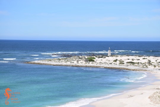
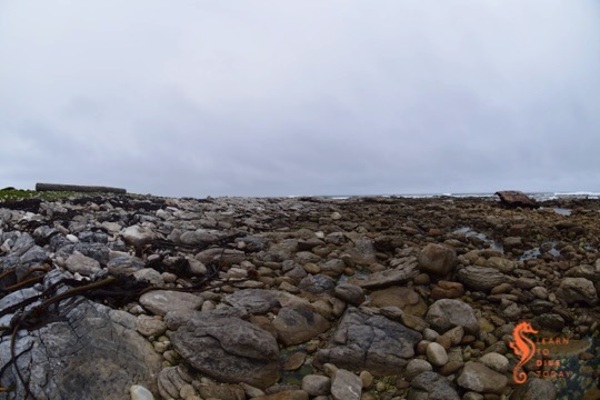
The beach at Otter Bay
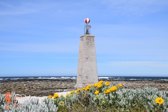
Struispunt marine light
On Struispunt is a marine light, or beacon, which is essentially a wannabe lighthouse! I walked down the beach to visit it, and back on the sand road behind the beach. The beacon is a masonry tower 10 metres high, topped with a red and white striped globe for daytime navigation and a relatively small, solar-powered light (1,747 candelas) that flashes three times every fifteen seconds. The water off Struispunt is very shallow, only about five metres deep for some distance from the light, so its presence is essential.
Struispunt
The Struispunt light was erected following the wreck of SS Queen of the Thames, in 1871. It is visible for 11 nautical miles. Its western and eastern sides were painted red and white for a while, but most of the paint has worn off and I could only discern a faint reddish tinge. Behind the light, on the rocks, many gulls and cormorants were roosting when I visited. There were also some human fishermen nearby!
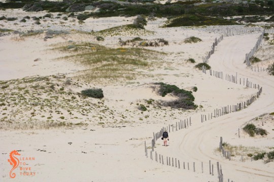
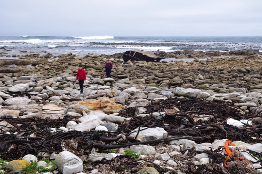
Tony took this picture of me walking back from the light
With increased use of Durban and South Coast beaches after the Second World War – numbers of swimmers and surfers increased exponentially – the incidence of shark attacks rose to the extent that, already in the 1940s, newspaper articles discussed possible “anti-shark” measures. Four shark attacks occurred in December 1957 (known as “Black December” by Durbanites), and by April 1958 a further three had occurred. Five of the seven attacks were fatal, and they occurred at the beach during summer – a crowded, public space. In the same way that the early 21st century shark incidents at Fish Hoek beach could be described as a “public trauma”, these attacks traumatised both Durban locals and holidaymakers from South Africa’s inland provinces.
The history of anti-shark measures and shark research in KwaZulu Natal is traced in detail in this Masters thesis by Melissa van Oordt, which, if you have an interest in the subject, I recommend you download and read. Van Oordt argues that myths about sharks, developed in the minds of the public following shark bite incidents along the Natal coast and fuelled by the media, drove the formation of the Sharks Board and the installation of the bather safety gear along the KZN coast. Sharks were characterised as “rogue”, “man eater” and “brute” – and the language used to describe them shaped the response.
The first nets were deployed in 1952 off Durban’s beaches by an organisation called the Durban Beach Committee, following the lead of New South Wales in Australia (nets were set there in 1937). After 1964 the beaches on the South Coast were also netted. Other measures, such as helicopter patrols and setting off depth charges, were experimented with, but were found to be ineffective, too expensive and/or too destructive to other marine life.
(It is also worth mentioning that already in 1958 measures such as electrical and chemical shark repellents and mechanical barriers were under discussion. In 1968 -69 development of an electrical shark barrier had made such good progress that full-scale testing at a Natal beach was anticipated “in the near future” [van Oordt page 113]. It has taken over half a century for these ideas to begin to come to fruition, and there is still some way to go.)
Establishment of the Natal Anti-Shark Measures Board
In 1964 the Natal Anti-Shark Measures Board was legally constituted by Natal Provincial Ordinance No. 10, which is freely available from the National Library (this is where I got my copy). The board was formed as a body corporate, which meant among other things that it could “sue and be sued.” Its functions and duties included:
taking advice from, considering findings of, consulting with and calling upon scientific and technical research bodies or individuals on the subject of “bather protection against shark attacks”; and
considering existing and proposed bather protection schemes to determine their effectiveness, and improving or supplementing them where necessary.
Local government authorities would provide the Anti-Shark Measures Board with estimated expenditure figures for anti-shark measures, as well as plans for any “actual or proposed anti-shark scheme” to which the expenditure figures related. The Sharks Board would vet the schemes proposed by the municipalities, suggest improvements, and approve expenditure for the anti-shark measures. Approved bather protection schemes would be subsidised by the board by at least ten percent of the municipal expenditure.
The Sharks Board was also authorised in the 1964 ordinance to install bather protection schemes on parts of the coast that were not under the jurisdiction of a local authority, and where agreement could not be reached with a local authority regarding the nature of a bather protection scheme, the board was able to go ahead and install shark safety gear, and recover some or all of the costs of doing so from the municipality concerned. This is quite a significant power – I would be curious to know whether it has ever been exercised.
The Sharks Board’s source of funding was declared to be “donations and bequests received by it”, as well as funds “appropriated by the Provincial Council for the purpose” – in other words, funds distributed to the Sharks Board by the Natal provincial government.
The Sharks Board was thus established legally, with most of its funding coming from the Natal provincial government. It had fairly broad powers in terms of installing bather protection gear along the Natal coastline, and no particular prohibitions on what it could and could not engage in.
Changing attitudes
White shark in False Bay
Van Oordt describes how, in the 1980s, the Sharks Board began releasing live sharks caught in the nets, reflecting a changing view of sharks, and the environment in general, that had begun to emerge among scientists and the general public. In 1991, in a further concrete indication of changing attitudes to sharks, great white sharks were legally protected in South African waters, making it illegal to catch or kill them unless authorised by the Department of Environmental Affairs.
Until fairly recently (at least until 1998 and possibly 2003) it was the case that:
The NSB sells certain shark products to defray expenses. Income from such sales is small relative to total expenditures. Products sold from the Board’s curio shop include shark teeth – sold either loose or with a jump ring for attachment to a jewellery chain – and entire jaw preparations. In addition, dried fins are stockpiled and sold, usually annually. Initially sales of fins were to local exporters by a tender process but the NSB is now investigating direct export. Fins and teeth from great white sharks Carcharodon carcharias are not sold because the species is locally protected. The meat from netted sharks is generally not sufficiently fresh for human consumption. Experimental inclusion of the meat in animal feed has been unsuccessful. [Source]
As we will see in the following post, such sales of shark products were forbidden by an act of 2008 which superseded the 1964 ordinance that established the Sharks Board. This, too, could be an indication of changing attitudes towards sharks and shark conservation in South Africa.
The KwaZulu-Natal Sharks Board (KZNSB) is frequently discussed, and often vilified, among ocean-loving South Africans. Rumour abounds; whole websites, devoted entirely to inaccurate speculation, exist. When the Sharks Board tested a shark repellent cable in the waters of Cape Town, starting in late 2014, I was frustrated by my lack of knowledge about how the KZNSB is structured, who funds it, and who mandates it to do what it does. Understanding these aspects of the Sharks Board’s operations could surely assist with moving towards a future where, if the Sharks Board still exists, it uses primarily non-lethal shark mitigation measures. (Unfortunately, no scalable measures suitable for the KZN coastline exist yet.)
Many people are concerned by declining shark populations, but many people are also concerned about their safety when they go for a surf or a swim. These groups overlap, but not wholly. The ideal shark mitigation measure combines bather safety with shark conservation. Examples exist, but they are rare. Cape Town’s Shark Spotters do an excellent job of striking a balance between safety and conservation, but what many commentators – who advocate deploying shark spotters at sharky beaches the world over – do not admit (or realise) is that Shark Spotters works because in Cape Town we have elevated ground close to the ocean, and great white sharks that spend a lot of time swimming on the surface when they are inshore. Take away one of those two crucial elements, and an already tricky job becomes exponentially more challenging.
What the KZNSB does
The KwaZulu-Natal Sharks Board protects bathers in KZN with what are essentially fishing measures: 23.7 kilometres of gill nets and 79 drum lines are installed along 38 beaches in the province. These nets and drum lines catch sharks and other marine creatures. The nets are checked by Sharks Board employees, and live sharks (and other animals) are released. Sharks that don’t survive are used for a variety of research – the Southern African Shark and Ray Symposium in September featured at least six presentations based on samples and data obtained from the Sharks Board.
While it is legal (read carefully – I am not condoning the practice) for the Sharks Board to remove sharks from the ocean, it is no longer considered ethical for scientists who wish to study sharks to use lethal sampling methods – to go out and shoot a shark so that they can study its stomach contents, for example. This practice would also be illegal for sharks that are protected, such as great whites in South Africa (the Sharks Board is permitted to catch them, however). There is much about shark biology that can be learned from a dead shark – for example an understanding of its reproductive systems, its position in the food web, its diet, samples to determine genetic inter-relatedness of populations, and age and growth data can all be gleaned from a necropsy. Perversely, much of the scientific output obtained from these avenues of research is useful for shark conservation and management planning. This is why, when a shark washes up dead or is accidentally caught in the Western Cape, scientists are keen to learn as much as possible from a dissection.
The website of the KZNSB describes a number of measures that the Sharks Board has taken to reduce its catches of species other than sharks. In particular, entanglement of cetaceans such as dolphins and baby whales is (apart from the environmental impact and sheer wastefulness) a highly emotive issue and a public relations nightmare for the Sharks Board and they actively seek to mitigate this kind of by-catch. In 2014, only about 40% of “non-target species” caught in the nets were released alive (no whales were killed).
How does the KSNZB, an organisation whose activities have a potentially significant impact on shark populations, fit in with broader initiatives to take better care of South Africa’s sharks?
Shark Biodiversity Management Plan
Puffadder shyshark at Long Beach
In March of this year, South Africa’s Shark Biodiversity Management Plan was published by the Department of Environmental Affairs. It is a remarkable document and represents the culmination (and the beginning) of a great deal of work by a great many people. It deserves (and will hopefully get) a more detailed examination than this, but I have isolated the sections that pertain to the KZNSB because they shed light on how the KZNSB is characterised by the government, and on the pressures it is under.
In the South African Shark Biodiversity Management Plan on pages 13-14, the KZNSB is listed as an organisation that “actively support[s] the management and conservation of sharks”.
On page 29 the KZNSB is listed as a responsible party under part of the Biodiversity Management Action Plan, with things to do in order to effect conservation of sharks in South African waters. The KZNSB is to “research and implement methods mitigating by-catch (e.g. drum lines)”, high priority, to start within a year of March 2015 and to be completed within five years; and to “investigate alternatives to shark fishing systems”, with the same priority and timeline. We know that the KZNSB has been actively testing alternatives to nets and drum lines – their shark repellent cable test in Cape Town’s waters is a case in point.
Page 25 states that the KZNSB is “cognisant of the need to minimise the environmental impact on biodiversity, while striving to improve/evaluate methods that have a lower environmental cost.”
The piece of legislation (more on this later) that establishes the Sharks Board mandates the sharks board to consider alternative mitigation methods, to reduce environmental impact, and “enhance the survival of caught sharks and other marine animals.” The particular section of the act defining the Sharks Board’s mandate is quoted in the KZNSB 2014 Annual Report (pdf). The report also suggests (on page 23) that pressure from environmental groups is providing an additional impetus to the development of other bather protection strategies.
All this underscores the fact that the Sharks Board is expected to find alternative (non-lethal) shark mitigation methods, and is legally mandated to attempt to do so.
National Plan of Action for Sharks
The South African National Plan of Action for Sharks (NPOA) sets goals for the implementation of measures towards ecologically and economically sustainable shark fisheries, and aims to improve conservation and management of sharks found in South African waters. The KZNSB is mentioned on page 13 of the NPOA document, as a “directed shark fishery”, with a reminder that
In terms of the provincial KwaZulu-Natal Sharks Board Act, 2008 (Act 5 of 2008), the KZNSB is required to endeavour to introduce schemes that will reduce negative impact on all biodiversity. In addressing biodiversity issues the KZNSB has already reduced the number of nets, introduced drum lines, and has removed shark fishing gear during the annual winter sardine run.
The Sharks Board is thus recognised in its capacity as a shark fishery in the NPOA document and mandated to conduct itself as described above (a broad requirement), as well as a potentially important player in the conservation of South Africa’s sharks in the Shark Biodiversity Management Plan.
Concerns
On page 23 of the KZNSB 2014 Annual Report (pdf), it is noted that one of the “challenges” facing the Sharks Board is that “other organisations are also developing environmentally-sensitive shark repellent technologies which may compete with that being developed by KZNSB.” I don’t know how exactly to read this, but it seems that the Sharks Board is concerned that if another entity were to develop a shark mitigation technology that doesn’t kill sharks, this would be a bad thing for the KZNSB. I can only infer that this refers either to potential lost profits from licencing a KZNSB-developed product, or to costs that the KZNSB would potentially incur should they be forced to implement an environmentally friendly shark mitigation technolgy developed by someone else.
Either way, it establishes a strong financial motive – at least at top management level – behind efforts to develop non-lethal shark repellent strategies. While this impurity of motive may not warm your environmentalist’s heart, a quick scan of the KZNSB annual reports should convince you that it is more analogous to a corporation than to an environmental organisation or charity and it should be expected to operate as such. Individual motivations of staff and researchers within the Sharks Board may well be related to shark conservation, but the organisation as a whole must remain financially viable.
A news report in November 2014, to which I have not been able to find a follow up, quoted the KZNSB CEO as suggesting that the Sharks Board be able to sell shark meat, fins, and other curios manufactured from shark products (such as teeth) in order to raise funds. The difficulty with this suggestion – which is expressly forbidden in the 2008 KwaZulu Natal Sharks Board Act – is that it could create an incentive not to release live sharks caught in the nets, or for the Sharks Board to deliberately harvest sharks in order to turn a profit.
In summary
What I hope I have provided is an overview of some facts about the Sharks Board that can be obtained from publicly available sources, all of which I have linked to in the text. I will do two follow up posts in which I will look at the origins of the Sharks Board and the legislation (from 1964 and 2008) that gives it its mandate and legal structure. Do ways exist in which concerned, rational, ocean loving citizens can work to create a future in which the South African coastline is free of nets and drum lines? What kind of things should we support in order to make the whole of South Africa – and not just Cape Town – a world leader in shark mitigation techniques?
At the very least an understanding of the entity that is the Sharks Board may assist in determining whether a particular form of activism or protest about its activities is likely to have any effect. And if a form of protest is not going to be ineffective, regardless of the passion and enthusiasm behind it, those energies could be better spent on one of the many other threats to the marine environment.
If you’re planning a trip to Cape Town and have a love of shipwrecks on shore, you’re in luck. Visiting some of the wrecks that are visible above the water around the Cape Peninsula can be combined with your exploration of the city, and will ensure that you don’t miss any of its outdoor highlights. Some of these visible shipwrecks can be reached by road, and one or two of them will require a short boat ride.
A map showing all these wrecks can be found here. A mini travel guide to Cape Town’s shipwrecks on shore, in the form of an ebook entitled Cape Town’s Visible Shipwrecks and written by yours truly, is available here.
In addition to the general shipwreck artefacts on display at the museums listed above, you can check out the following specific wreck remains, some of which are not labelled or take a little bit of finding:
The wreckage of the Phyllisia, and a huge log on the beach
There are three visible shipwrecks inside the Cape Point section of Table Mountain National Park. Two of them, the Thomas T Tucker and the Nolloth, are accessible along the Shipwreck Trail in the nature reserve. The third, the Phyllisia, is visible at the turning point of a walk called the Phyllisia Circuit, that starts and ends at Gifkommetjie in the south western part of the reserve. (The formerly visible wrecks, the Tania at Buffels Bay and the Shir Yib at Diaz Beach, are no longer visible, having been reclaimed by the sea.)
Tami and Maria on the rocks in front of the Phyllisia
The Phyllisia was a Cape Town fishing trawler of 452 tons. She struck submerged rocks a short distance offshore, close to midnight in early May 1968. Holed in four places, she was partly submerged but remained intact for some time. Eleven of her crew came ashore in life rafts, and the remaining 14 were airlifted off by helicopter.
Approaching the Phyllisia over the rocks
The stern of the Phyllisia
The Phyllisia is best visible at low tide
Initial plans to salvage the wreck were scuppered by continued heavy weather, and after the removal of the moveable equipment from the ship, she and her cargo of 30 tons of fish were left to the elements. All that remains of the wreck on the shore is part of her stern.
A cloudy day at the Phyllisia
The walk to the Phyllisia from the Gifkommetjie parking area is about 2.5 kilometres, and I will describe the route in more detail in a separate post about the Phyllisia Circuit. She is best visited at low tide, so that what remains of her stern is fully exposed on the rocky shore. Look out for the various smaller bits of metal in the area, and also for the massive log that probably has the same origin as the one at Olifantsbos.
Lovers of shipwrecks and wilderness will enjoy the Shipwreck Trail (also called the Thomas T Tucker Trail, which has a nice alliterative ring to it) in the Cape Point Nature Reserve. Tami, Maria and I did it on one cloudy Saturday, close to low tide. (You can do the walk at high tide, but you won’t be able to get as close to the wrecks and some parts of the wreckage will be underwater.) The trail starts from the Olifantsbos parking area inside the reserve. There is a large sign saying THOMAS T TUCKER, which will send you on your way. A waist-high pyramid-shaped cairn of stones indicates where you must climb over the dunes onto the beach – the actual path is hard to discern at this point owing to fire damage.
Rockpools abound near Olifantsbos
The path follows the coast past the Olifantsbos Cottage to the next beach, where the remains of the Thomas T Tucker are strewn around. Don’t rush past the beach outside Olifantsbos Cottage, though – there is a huge wooden log, bored by teredo worms, with rust marks at its base showing where it was attached to the deck of a ship or where fittings for lifting by crane were located.
It is possible that this is one of several hundred okoume logs that came off a cargo vessel called Lolain Table Bay in 2008. The ship was apparently in very bad repair. Similar logs can be found at Hoek van Bobbejaan, Sandy Bay, and other locations along the Atlantic coast. (Incidentally, those logs were predicted to cause havoc in the 2008 storm that uncovered the wreck of the Commodore II.)
The mast on Olifantsbos beach
On the beach near the Thomas T Tucker you will also see some whale bones, which are becoming more and more damaged with each passing selfie, but are still impressive in scale. I suspect that more of that skeleton is on display at the Buffelsfontein Visitors Centre near Buffels Bay in the park.
Whale skull near the Thomas T Tucker
Continuing past the main wreckage of the Thomas T Tucker you will come across another small piece of rusty metal, which belongs to the same wreck even though it is so far away from the rest of the debris. Shortly you will spy the wreck of the Nolloth on the beach before you. Don’t overlook the rockpools on the way.
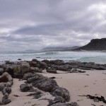
Moody skies over Misty Cliffs
A cairn marks the entrance onto the beach
Tami and Maria on the way
Rocky shores near the head of the trail
Ours were the first footprints on the beach
Scarborough and Misty Cliffs in the distance
Looking back from near the Olifantsbos cottage
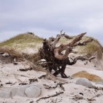
Blasted tree at the southern end of Olifantsbos beach
What makes these tracks on the beach?
A mysterious abandoned buoy in the surf at the Thomas T Tucker
The Nolloth is in the distance
Fishing net on the beach between the two wrecks
Lush green south of the Nolloth
Fire damage near Sirkelsvlei
Teredo worms have bored into the mast
The route back can either be a retracement of your steps along the coast, or via the inland path marked by a sign on the edge of the beach just past the Nolloth. We struggled a bit to find the path as the plant life in the area has not recovered since the March fires, and in retrospect we’d probably have gotten on much better (and returned home much cleaner) if we’d just walked back along the beach!
Baboon footprints on Olifantsbos beach
You shouldn’t do any walking in the reserve without a proper map; my favourite is the Slingsby Map series. I got mine from the curio shop at Kirstenbosch, and they are available at most major bookstores (with a bias towards those in the south peninsula – I have seen them at both Wordsworth and at the Write Shoppe in Long Beach Mall). Be aware of and grateful for the baboons, don’t advertise your snacks, don’t go alone, and always take something warm with you even if it’s a sunny day when you set out.
Three adventurers at the Nolloth – me, Tami, Maria
In case you missed the links in the text, check out the separate posts on the two wrecks you’ll see along this trail: the Thomas T Tucker and the Nolloth.
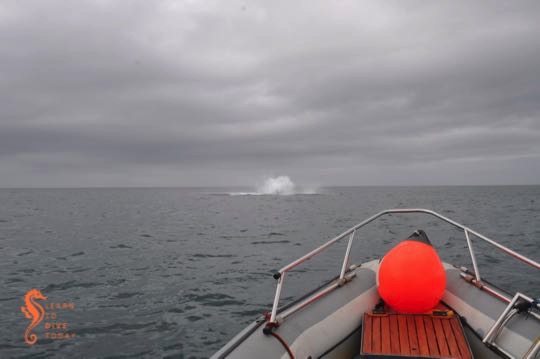
We had fairly good conditions in False Bay on Tuesday and were lucky enough to have a whale breach less than 50 metres from the boat. I wish they would warn me when they do this so I could get the camera out and get some whale in the picture instead of just splash.
Tail end of a breaching whale
The weather ahead for the next few days is a little odd but Sunday looks like the better day and the Atlantic looks like the ocean to dive. Gordon’s Bay may also be a good option – contact Deon at Indigo to find out what your options are. Saturday is International Coastal Cleanup day, so you could also join a cleanup dive or head out to your local beach to participate in a cleanup effort. The Two Oceans Aquarium is hosting a cleanup at Melkbos Beach, and if you play your cards right you could enjoy a free trip on the Ocean Adventurer after participating in the cleanup. More info on that here.
We are not launching this weekend as we are headed to the De Hoop Nature Reserve on an exploration expedition… Hopefully the end product of this will be a future dive trip to that part of the coast.
The organisers of the 2015 Southern African Shark and Ray Symposium made an effort to include the public in the celebration of False Bay, the marvelous ecosystem on our doorstep.
#LoveFalseBay speaker evening
The first event to do this was a free speaker evening, held at the Bluebird Garage in Muizenberg on Monday 7 September. Hundreds of people attended; I took the photo above before the room got so full that no one could move!
Eleven speakers presented short talks about False Bay. We heard about the whales, sharks, orcas, and invertebrates and how they are being studied; about transformative social work taking place in the waves; and about what we can do to care for the bay.
Photographic exhibition
Also taking place starting during the week of the symposium and continuing all summer, is a free public photographic exhibition of Joris van Alphen and Mac Stone’s images of False Bay, taken last summer. You can visit the exhibition along the catwalk between Muizenberg and St James. It’s in the same spirit as the Sea-Change exhibition that was up in Sea Point last summer, and I am excited that it will allow non-diving residents of Cape Town to see some of what goes on under the surface!
Welcome evening
Shark & Ray Symposium welcome evening
Storify, which I originally used to curate the tweets about this evening, is dead. However you can access the story as a pdf by clicking this link.
Being (in midlife) a creature of the south peninsula, I tend to focus my attentions on False Bay and the Atlantic coast from Hout Bay southwards. But there are rewards for the shipwreck hunter who ventures further north, and even for the shipwreck hunter who doesn’t necessarily want to get their feet wet. A visit to Milnerton beach, and a walk north from Milnerton lighthouse, reveals two shipwrecks in the surf zone. Milnerton beach is surpassingly filthy, but while I was there a beach cleanup was making some headway on the mounds of rubbish tossed off ships in Table Bay that ends up on the beach. The view of the lighthouse from the beach is also far more fetching than the view from the car park, if you can overlook the garbage.
Milnerton lighthouse
About one kilometre north of the lighthouse, where the beach is cleaner and pebbles roll euphoniously in the waves, you will come across the massive boilers of the Hermes in the surf. The NSRI gets calls every year from concerned locals worried that a whale is stranded near the beach; the sea spray sometimes pushes through holes in the top of the wreck creating an illusion of a whale’s blow. The Hermes was a liner, built in 1899, on her way to Cape Town with a large cargo of livestock, forage and a few passengers. When she arrived in May 1901 the harbour was full, and she was forced to drop anchor for the night. A north westerly gale came up, she dragged her anchors, and when the captain ordered her engines started, they failed.
Hermes (front) and Winton (back)
Seawards and to the north of Hermes, the engine block of the Winton is visible, in much the same way as the SS Clan Stuart can be seen at Glencairn in False Bay. The Winton came aground in July 1934, carrying a cargo of wheat from Port Lincoln in Australia to Liverpool, England. Her captain was unfamiliar with Table Bay and had mistook the red lights on top of the radio mast at the Klipheuwel Wireless Telegraph Station near Milnerton for the harbour lights. Attempts were made to pull her off the beach and some of her cargo was salvaged, but the wheat ignited and efforts to refloat her were to no avail.
The visible remains of the Hermes
Hermes (left) and Winton (right)
Hermes in the surf zone
On a calm day, an aerial view of the site reveals the full outline of both vessels surrounding the parts that protrude from the water. When I visited, it was rough after a large swell, but the tide was low. At high tide the view will be considerably less impressive.
The boilers of the Hermes in front of Table Mountain
It is possible to scuba dive this site, and Underwater Explorers dives the Winton every year during their summer Table Bay wreck diving jamboree. Obviously very calm, low swell conditions are required because the wreck is so shallow and so close to the beach.
We first saw the Commodore II on Lagoon Beach, Milnerton, when we went to Sophie and Jacobus’s wedding. It was a summer’s day, and she had a boogie board and a pool noodle lying on her keelson, a bride and groom (not Sophie and Jacobus) posing for photos on her, and a gazebo secured to some of the rivets protruding from her timbers. I was fascinated by the strength and size of what remains of the ship, and returned on a clear winter morning, before the beach filled up, to look at her again.
The Commodore II was a four masted schooner built in the United States, with a film credit as one of the sets in the 1935 Clark Gable film Mutiny on the Bounty. Privately owned, she ended up in Durban in the late 1930s and fell into disrepair after her owner died.
Commodore II in Table Bay
She was then towed to Saldanha, where she became a floating coal hulk during World War II. After the war she transported coal to South America and timber back to South Africa, but according to one of her crew, the ship ran into many difficulties and conditions on board were dire.
It was either in 1945, 1946 or 1948 (sources differ but I tend to believe the 1946 or 1948 dates) that she was set on fire and allowed to run aground off Milnerton. This was apparently considered an acceptable way of disposing of the vessel.
The lagoon mouth at Milnerton, and the Commodore II
The Commodore II was sturdily built
Rivets on the Commodore II
Not done yet, the Commodore II made an appearance in 2008, when a storm uncovered her remains at Milnerton. At the time the Cape Argus published an interview with one of her former crew, who described his love for the ship and described some of her history. I’m not sure of the status of the wreckage between 2008 and 2013, but the NSRI suggests that during that time the wreck washed into Milnerton lagoon and was secured inside the lagoon by residents who feared for the safety of water users if she was left to move about at will.
Steam rises off the Commodore II in the morning sun
In September 2013 she came loose and washed out of the lagoon onto the beach. City officials promised to remove her, but two years later they still have not (for which I am glad). Today she lies in front of the Lagoon Beach Hotel, at times right on the edge of the Milnerton lagoon mouth (which moves around on the beach a bit). It is quite conceivable that another storm will wash her off the beach, back into the lagoon, or to a slightly different location, but for now she makes for an arresting sight on a crisp morning.
Finally, because it’s special, here’s one of the official trailers for Mutiny on the Bounty, featuring the Commodore II. I assume that’s her in the long shots, and perhaps the deck and below-deck scenes were also filmed on her. Enjoy –