Bookshelf: Beachcombing in South Africa

Beachcombing in South Africa – Rudy van der Elst

Beachcombing in South Africa

Why so quiet? What have we been doing? Working, mostly. Trying to stay alive. And a bit of reading, and some beachcombing. Enter this is marvellous little book from fish fundi Rudy van der Elst (A Field Guide to the Common Sea Fishes of South Africa).

Chapter by chapter, van der Elst describes the types of debris that one might find on a beach. After a brief orientation chapter covering the ocean current regime around South Africa, relevant regulations, safety, beach ecology, tides, pollution and more, we launch into a tour of washed-up treasures.

Predictably, many of the items to be found are organic in nature – plants, invertebrates of various types, eggs and egg cases, fishes, birds, and shells. There are also items such as oceanographic devices, tags from marine animals, fishing equipment, cyalumes, buoys – some of these (such as tags) should be returned to their owners, and others should be removed from the vicinity of the ocean (such as discarded fishing nets and lines).

The chapter on marine animals (resting, nesting and stranded) is exceptionally useful and it is almost for this alone that I’d like to put a copy of this book in every home in every coastal town in the country. Seals, whales, turtles and seabirds can end up on the beach, sometimes in difficulty and at other times not. It can be hard to tell, and well-meaning members of the public can unwittingly cause great harm while trying to assist. A list of useful contacts in this regard appears at the end of the book, such as the Two Oceans Aquarium and the SPCA (region-specific).

The final two chapters cover miscellaneous “treasures” such as fossilised sharks teeth, sea glass, logs, and actual treasure, as well as beachcombing through the ages in South Africa. Here we learn about tidal fish traps, coastal caves, and other historical coastal dwellers who made their living from the sea.

We’ve found some awesome things on the beach, from shipwrecks to goose barnacles to rare crabs. Beachcombing is an accessible hobby that requires nothing but time, observation skills, curiosity, and a beach to stroll on.

This is a beautifully illustrated, comprehensive little volume that deserves to come with you on your beach holiday. It’ll prompt more careful examination of the flotsam and jetsam on your local beach, and, probably, more early morning low-tide visits to find the best pickings!

Wild Card magazine featured this book when it was published. Get it online here if you’re in South Africa, or here for your Kindle.

The new Cape Point lighthouse

View of the new Cape Point lighthouse from the sea

To me it would seem totally logical to build a lighthouse as high above sea level as possible. As we saw with the old Cape Point lighthouse, there is such a thing as too high, particularly when you’re building in an area that is prone to heavy mist and fog. The most notable shipping casualty that occurred after construction of the old Cape Point light was that of the Lusitania, wrecked on Bellows Rock in 1911. A new lighthouse was planned, along with a light at Slangkoppunt in Kommetjie, to replace the old light at Cape Point.

View of the new lighthouse at Cape Point

The new lighthouse was built on a 15 metre high pinnacle of rock called Diaz Point, which was dynamited to form a flat platform upon which the lighthouse would be built. Building materials were hauled by oxen from Simon’s Town, and transported by tram down a track on the cliffs. Most of the way the gradient of this tram track was 1 in 4; for a short stretch it was 1 in 2. This is incredibly steep. At the end of the tram track, the building materials were lowered by crane onto a ledge. Building sand was excavated from a cave at the bottom of the cliff, and carried up to the platform on which construction took place. Water was brought close to the building site by trolley, and piped down onto the location.


Like the old lighthouse, the new lighthouse is nine metres high, but instead of cast iron, it is constructed from masonry and the tower is square. The lantern house on top is white. The new lighthouse’s elevation is 87 metres above sea level, giving it a range of visibility of 32 nautical miles. The fully automatic light flashes three times every 30 seconds, and there is a subsidiary red light in the base of the lighthouse facing towards Anvil and Bellows Rock. This light is only visible from the sea, if you go around Cape Point to the western side of Cape Point.

On 11 March 1919 the new lighthouse was commissioned (put into service). The view from this lighthouse covers a full 353 degrees, with seven degrees obscured by Da Gama Peak behind it. It was manned for a time, but is now automated.

Getting closer to the new lighthouse

The public is not allowed to visit the new lighthouse, or even to get particularly close to it. It can be viewed from a viewpoint at the end of the Lighthouse Keeper’s Trail, a highly recommended short walk from the old lighthouse at Cape Point. Along the way you will see the remains of World War II bunkers and a radar station, and you will traverse the most fantastically narrow ridge of rock (in perfect safety). The wind is likely to be extremely strong, whatever time of year you go – dress accordingly. Also note that the walk does not take nearly as long as is suggested by the signage at the start. It is approximately one kilometre each way.

View from the old lighthouse towards the new one

As usual, everything I know about this lighthouse that I didn’t learn by looking at it (i.e. most everything), is thanks to Gerald Hoberman’s wonderful Lighthouses of South Africa book.

Peet’s Vulcan Rock video

Urchins, brittle stars, corals at Vulcan Rock

Peet made this amazing video while diving Vulcan Rock with us. There is a huge cave with several entrances at the bottom of the reef, and he went inside to check it out.

[youtube=”http://www.youtube.com/watch?v=QPLmfoJnhqU&w=540″]

Bookshelf: Mountains in the Sea

Mountains in the Sea: A Celebration of Table Mountain National Park – John Yeld & Martine Barker

Mountains in the Sea

Mountains in the Sea is a beautiful coffee table book showcasing the beauty and history of Table Mountain National Park, which stretches the entire length of the Cape Peninsula, in between the urban areas. There is minimal text by veteran environmental journalist John Yeld, and the photographs are from both authors as well as from the archives and other sources.

This is a really gorgeous volume that manages to inform by the choice of images as well as via the text. I have a list of new places I would like to explore after reading it, and half an ambition to do the Hoerikwaggo Trail. It is a wonderful souvenir for visitors, but also an excellent reference for Capetonians who want to get the most out of the natural environment on their doorstep.

You can get a copy of the book here. There is also a pocket-sized volume which has been of great utility to me during my explorations of Table Mountain National Park, but it is harder to find.

Bookshelf: Shorelines, Strandlopers and Shell Middens

Shorelines, Strandlopers and Shell Middens – John Parkington

Shorelines, strandlopers and shell middens

I’m currently delving into some subjects I know nothing about, stone age archaeology being one. I harboured a childhood dream of excavating ancient Egyptian artefacts, but that came to nought and I ended up a mathematician – manipulating things I can’t even see or touch. Ah well.

Strandlopers are the people who lived as hunter gatherers along the Southern African coastline, related to the San. A shell midden is basically an ancient dustbin, and the strandlopers would have generated these when they stopped at a location for any length of time. They are typically densely packed collections of shells that are all of a certain size (large enough to be worth harvesting and eating) and from a limited set of edible species. In this way they are distinguishable from random heaps of shells. A midden of considerable size would have been built up in a relatively short time owing to the sheer number of molluscs it is necessary to consume in order to have something approaching a decent diet! Shell middens exist around South Africa’s coast, including a couple in False Bay which I plan to hunt down. It is believed that the consumption of shellfish – which are extremely nutritious – by early humans contributed to increased brain size and the development of more complex civilisations.

John Parkington, the author of this book, is a lecturer in archaeology at the University of Cape Town. His writing style is clear and expository, and enabled me to follow along with little to no background knowledge on the subject. The book is extensively illustrated with photographs, including of Parkington’s collaborators at the university. I appreciated the fact that each person’s full name was provided.

If you’re interested in knowing more about the early history of humans along South Africa’s coast, I’d recommend starting with the series Shoreline, which provided an excellent introduction to the subject. The Sea-Change project also explores our ancestors’ interactions with the marine world.

You can find this book here, or perhaps at Kalk Bay Books.

Bookshelf: Empire Antarctica

Empire Antarctica – Gavin Francis

Empire Antarctica
Empire Antarctica

The Antarctic is the only continent that has no indigenous human inhabitants. The only people who occupy this ice-covered continent are scientists, kept company by penguins, seals, and other birds and marine mammals. Medical doctor Gavin Francis spent 14 months there at the British Antarctic base called Halley Research Station. He was drawn to the post by the prospect of the solitude he would experience and by the “blankness” of Antarctica – without human inhabitants, it lacks a cultural and historical context in the sense that we experience culture when we travel to other destinations. He was also enamoured of the emperor penguins that breed on the continent, and desired greatly to see them.

This is a beautifully written book. Francis steeped himself in the writings of explorers who visited the continent before him, and in the scientific literature of emperor penguins (though he does not mention having watched March of the Penguins or Happy Feet – clearly a gap in his research!). He alternates between lyrical and scientific frames of mind, evocatively describing the exploration of an ice cavern and then, in detailed practical terms, the dissection of a baby penguin. He does not mention very much about his human companions at the base, and I was glad of this. It gives a good sense of how he experienced his year on the ice – there were some other people there, but he was largely wrapped up in his internal experience of the place.

Francis structures his book around the passage of the seasons. This is a logical choice, as in Antarctica the cold and darkness of winter are magnified to the most extreme degree possible, only to be completely cast away by the endless days of the polar summer (not much warmer, however). There is enough information about the mundane details of his life on the base to satisfy one’s curiosity (for example, the modern outdoor clothing they used was so warm that even in a blizzard he could not feel the wind through his layers). But the focus is squarely on the continent itself, its beauty and inhospitable extremes. His descriptions of the emperor penguin colony close to the base, and the Adélie penguins found along the coast, are exuberant and moving.

The existential angst experienced by Francis as the end of his posting in the Antarctic draws nearer – should he return to civilisation? What should he do with his life? – is magnified by the lack of distractions on the ice. After a largely uneventful (yet fascinating to read about) year, he describes his subsequent life choices – marriage, three children – quickly, and glosses over what must have been a substantial period of adjustment to life in warmer, more populous climes. This is an incredible book that made me want to go to the ice, and stayed in my mind for some time after I finished reading it.

You can also read reviews from The Economist, the Telegraph and the Washington Times. Francis wrote for The Guardian about his experience at the end of the world – it’ll give you a good sense of his writing style.

You can get a copy here, here or – if you’re in South Africa – here.

If you’re as ice-obsessed as I am, also check out Endurance (for some historical context), and Ice Patrol.

A Day on the Bay: Running in the motors

Date: 6 April 2014

Team Aquaventures on board ready to roll

One Sunday in early April, Tony did a very early launch for an Aquaventures PADI IDC, taking the divers to the wreck of the BOS 400 and to dive with seals at Duiker Island in Hout Bay. You can see in the photo above that the sun hasn’t even reached Maori Bay as the divers kit up! The visibility on the BOS 400 was about six metres, and it was about eight metres at Duiker Island. At the wrecks inside Hout Bay (the Aster and Katsu Maru), there were reports of visibility of up to 15 metres.

After the early launch, Tony and I took the boat for a drive south towards Cape Point. We weren’t in a rush, partly because we needed to run in the boat’s motors gently, and so we stopped to look at the scenery.

Chapmans Peak drive
Chapmans Peak drive

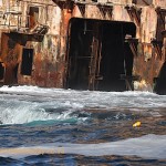
Chapman’s Peak Drive is carved out of the mountainside at the intersection of the Cape granite and sedimentary layers (geologists love this fact), and this can be seen clearly in areas where the mountain isn’t highly vegetated (such in as the photo above). Tony showed me a strange “door in the cliff” – a neat rectangular opening (it seems) that looks like it should be in The Hobbit. You can’t approach it closely on a boat because there’s foul ground in front of it, and the sea is turbulent even when there’s not much swell.

Sea spray on Long Beach, Noordhoek

Long Beach is long. There were lovely big waves, with spray unfurling from their tops in the light breeze. We could see horse riders on the beach, surfers in the swell, and at one point right across False Bay to the Hottentots Holland and Hangklip. Further down, the boiler of the Kakapo shipwreck was clearly visible on the sand.

Idle near a small kelp forest off Long Beach, Kommetjie

Slangkop lighthouse (pardon the blurry photo) is being painted, it seems – the building is completely clad in scaffolding. This was our turning around point, but first we had coffee and a snack. Boating makes you hungry!

Slangkop lighthouse getting a facelift

On the way back we stopped a few times to look around (Tony was looking for a whale shark, after NSRI report from St Helena Bay the previous day, and unconfirmed sightings of one in Kommetjie) and dangle our (ok, my) feet in the freezing water. There was an offshore wind blowing. In places the air was freezing cold, and in others the hot wind, smelling strongly of fynbos, made everything wonderfully pleasant.

We took a drive across the mouth of Hout Bay to Duiker Island, where the water looked quite clean. There were snorkelers in the water with the seals. I drove us back from the island (slowly) – I don’t have a skippers licence yet, and in order to get one I need (supervised) hours on the boat. So this was practice.

Once inside Hout Bay harbour, we milled around a bit waiting for the slipway to clear (some poachers were launching, amongst other activity). We came across the Seal Alert boat, which has sunk into disrepair but is a very enjoyable resting spot for some of the local seals. There are also a few boats that have sunk at their moorings – apparently because their drain plugs were stolen.

The middle (bright green) ship in the picture of the fishing vessels moored in the harbour in the above gallery of images, is the sister ship of a ship that ran aground off Betty’s Bay in February, breaking up and spilling huge amounts of fuel near the vulnerable penguin colony.

Video footage of Jackfish Alley (Ras Mohammed National Park, Red Sea)

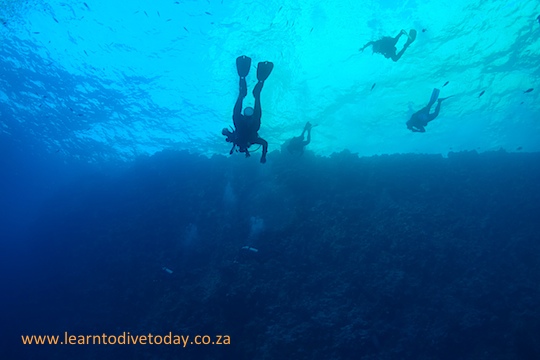
Jackfish Alley was an astonishingly beautiful dive site that we visited during our Red Sea liveaboard trip in October 2013. It’s inside the protected area formed by the Ras Mohammed National Park, and is one of those shining advertisements for Marine Protected Areas that we wish there were more of!

Very early on in the dive we went through a swim through – a hole in the wall of the reef that had an opening a short distance further on. This is what it looked like:

[youtube=”http://www.youtube.com/watch?v=3bfLKc-1G68&w=540″]

Kate checked out a huge coral head…

[youtube=”http://www.youtube.com/watch?v=K5j0ljEFrfE&w=540″]

… and I took these two panoramas, showing the coral garden that we swam through, and the spectacular topography.

[youtube=”http://www.youtube.com/watch?v=w1mXShjq-6g&w=540″]

Look how blue the water is!

[youtube=”http://www.youtube.com/watch?v=DDG9m3G6rH0&w=540″]

Dive sites (Durban): Blood Reef (Doug’s Cave to Birthday Ledges)

Descending near Doug's Cave
Descending near Doug’s Cave

For our last dive we enjoyed lovely drift dive in the fashion of Sodwana. We were aiming to drop in at Doug’s Cave, which is apparently a proper cave in which ragged toothed sharks occasionally lie in repose. Because of the current we missed the cave, and instead of fighting current to get back to it, we continued along the reef at a leisurely pace.

Boxy
Boxy

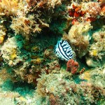
I was very excited to find a sort of overhang that seemed to be a meeting place for trumpetfish. There were two or three underneath the rock, and another one hanging about on a patch of sand in front of the little cave. The dive was incredibly colourful (especially when I got my strobe to fire correctly), and Maurice and Craig helpfully found several nudibranchs, and showed them to me.

Branching soft corals

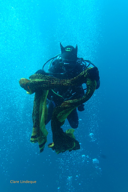
Towards the end of the dive, as we arrived at Birthday Ledges, we once again found the large piece of yellow and red fabric wrapped around part of the reef that we’d seen on our Birthday Ledges dive the previous day. Patrick, our Divemaster (and owner of Calypso) persisted, and managed to unwrap it. Tony confiscated it immediately, and put on quite a show at the safety stop. We’d had a long dive on the Coopers light wreck a couple of hours prior, so we were out of time before we knew it.

Raggy scorpionfish in repose

I thought the Blood Reef complex was amazing, with a lot to see. It’s suitable for drift dives in either direction, depending where the current is going (north-south or south-north), and if there’s no current, that’s also fine. It’s a fairly long boat ride by Cape Town or Sodwana standards (if you’re diving Two Mile), but you’re close to shore.

Dive date: 20 June 2013

Air temperature: 23 degrees

Water temperature: 22 degrees

Maximum depth: 20.1 metres

Visibility: 20 metres

Dive duration: 48 minutes

Draping the sarong
Draping the sarong

De Kelders drip cave

Entrance to the drip cave

On our way home from our short stay in De Kelders, Tony and I walked down the steps to the entrace of the drip cave (“drupkelder”), a cave on the shore which has a large freshwater river running through it that supplies the town of Gansbaai with fresh water. We weren’t able to go inside (it was by appointment and I think the person with the key was at the shopping mall).

The view from the cliff above the cave

The cliffs at De Kelders are riddled with caves, but this one is apparently quite unique because of the freshwater river inside it. It also contains beautiful stalagmites and stalagtites. It was visited by Lady Anne Barnard in 1798, and has recently (date uncertain) been threatened by a property development (which may or may not be the fairly unsightly building that currently stands on the land above the cave). I was interested to see in the article about the property development that there was concern that the whales would be chased away from the coast by the bright lights from such a large building.

Tony going down the steps

The concrete structures around the entrance to the cave are related to its use as the water supply for Gansbaai, while the wooden poles are part of a restaurant facility that the owners of the land planned to erect. Probably better that they didn’t.