Hello, Smith’s swimming crab!

One of the things I love about False Bay, and about Long Beach in particular, is the tendency for creatures from all over South Africa’s coastline to end up here, often tropical marine life that got caught in the warm Agulhas current, and then within the circulation of False Bay, ending up just behind the Simons Town harbour wall.
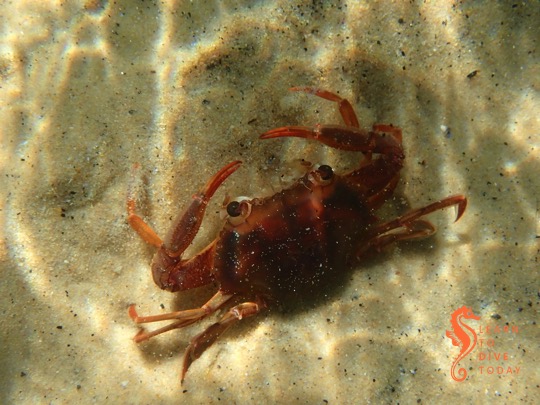
Smith's swimming crab (Charybdis smithii) Smith’s swimming crab (Charybdis smithii)

Thus it was, early in March, that we discovered several adult specimens of Smith’s swimming crab (Charybdis smithii) at Long Beach when we went for a dive. One or two were already dead, and the rest were struggling either on the sand, or in the shallows, looking unhealthy. The water temperature at the time was about 17 degrees.

The first hint that this unusual and rarely-seen visitor had arrived on our shores was a series of social media posts, from January, in one or two of the fishing groups I follow on facebook. (These are excellent places to keep tabs on what’s happening in parts of the ocean I might not routinely visit, and there’s a wealth of knowledge and experience among the members.) Here’s a conversation between local fishermen about seeing large numbers of adult Smith’s swimming crabs just off Cape Point (also facebook). You can also see some photos of one of the crabs from Sea-Change here (facebook), taken on 22 January in False Bay.
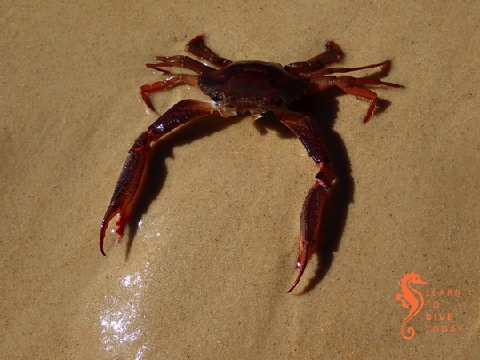
Smith's swimming crab (Charybdis smithii) Smith’s swimming crab (Charybdis smithii)

At the same time as these social media posts, there was an influx of small, red crabs on the other side of the Cape Peninsula, at Long Beach in Kommetjie. (But more on that in another post.) Two Oceans says that Smith’s swimming crabs were first described in False Bay in 1838, and then again in 1978, 1983, and 1993. This facebook thread suggests that they may have been last seen off Muizenberg around 2005-2006.
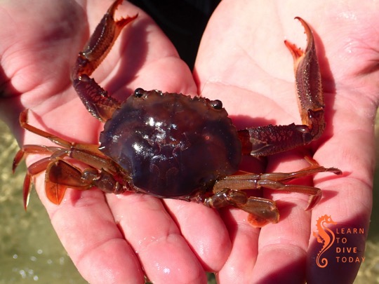
Smith's swimming crab (Charybdis smithii) Smith’s swimming crab (Charybdis smithii)

I read more about Smith’s swimming crab in two papers: this one (Romanov et al), from 2009, and this one (Van Couwelaar et al) from 1997. The more recent paper updates many of the findings of the earlier one. Both teams of scientists behind these papers used trawl data from pelagic cruises to learn about the distribution and life history of these crabs.

Smith’s swimming crab is a pelagic crab that spends the vast majority of its one year, monsoon-driven life cycle in the water column. They are endemic to the western Indian ocean, and are usually found in the area bounded by the Arabian sea (which is west of India) and the latitude of Dar Es Salaam in Tanzania (about 7 degrees south of the equator), and from the east African coast, across east to the Maldives. They may congregate in huge patches, larger than tens of square kilometres, and may reach a biomass of more than 130 kilograms per square kilometre. These swarms are densest between June and September. During July, their concentration can peak at more than 15,000 individuals per square kilometre.

Smith's swimming crab (Charybdis smithii) Smith’s swimming crab (Charybdis smithii)

The crabs congregate on the seafloor of the continental shelf during the months of September to December, mating late in the year. No adult crabs are usually seen between April and June (Van Couwelaar et al speculate that the adults die after breeding), at which time, after metamorphosis, the swarms again become apparent in the western Indian ocean. The crabs grow to about 7.5 centimetres carapace width.

The crabs seem to perform a diel migration, moving deeper in the water column during the day (down to 350 metres’ depth), and returning to the surface at night. They swim continuously and are voracious predators in order to support the high metabolic demand created by this constant activity. They are able to regenerate all their limbs except for their swimming legs (Van Couwelaar et al deduced this in much the same way as Abraham Wald decided which parts of World War II bombers to reinforce – no crabs with partially grown swimming legs were caught in their trawls).

These crabs are important prey for yellowtail, as for other pelagic fish species such as blue sharks, yellowfin tuna and bigeye tuna. The fishermen of False Bay observed that they made excellent bait.
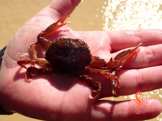
Smith's swimming crab (Charybdis smithii) Smith’s swimming crab (Charybdis smithii)

So what brings Smith’s swimming crab this far south? False Bay is way out of their range. This paper (Chapman, 1988) suggests that prior arrivals of these crabs on our shores have co-incided with weaker than usual summer south easterly winds (which has definitely been a feature of late 2018 and the start of 2019 – we had a gloriously wind-still summer for the most part) and the westward movement of warm water containing the crabs. We did have a spell of unusual westerly wind just prior to these crabs’ arrival.

A fascinating 1984 paper by George Branch describes a temperature anomaly during the summer of 1982-83. This particular Cape summer was characterised by very little of the typical south easterly winds, leading to reduced upwelling, and relatively high sea temperatures (Duffy et al, Effects of the 1982-3 Warm Water Event on the Breeding of South African Seabirds, 1984). The exceptionally warm water on the south and west coasts of South Africa caused mass strandings of some tropical animals (such as portuguese man ‘o war), mortalities of others (such as black mussels), changes in abundance of some species, and extensions of some species’ geographic range. For example, an exceptional number of juvenile turtles washed up on the beaches of False Bay, several months before the usual start of the usual turtle stranding season (which is, very loosely speaking, March-July). Prof Branch records that large numbers of healthy, adult Smith’s swimming crab washed up at Cape Hangklip, and smaller numbers at Boulders Beach, Strand, Milnerton and Blouberg. About 62% of the crabs were female, and many of them survived in aquaria for some time after stranding.

In short, it seems that we had our own little temperature anomlay, however brief, in early 2019, and the pulse of warm water brought with it these rarely seen (in Cape Town) crabs. What luck to spot this unusual visitor!

There are some lovely pictures of Smith’s swimming crab, healthy and in mid water, taken off Tanzania, here.

Newsletter: Who you gonna call?

Hi divers

Weekend dive plans

Saturday: Boat dives from False Bay Yacht Club

The forecast for Saturday looks rosy so we will launch from the Simon’s Town jetty at 9.30 and 12.00. Both dives will be shallow, most likely Roman Rock and Photographer’s Reef. False Bay is a little patchy so dive sites might change.

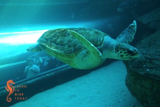
Yoshi the loggerhead turtle

Turtles

Amazingly, we still meet people who don’t realise that baby sea turtles – and even big ones, if they’re poorly – can’t survive for long in the cold waters around the Western Cape. Luckily the Two Oceans Aquarium has a well-developed turtle rehab facility, where they look after turtle hatchlings and older turtles brought in by members of the public.

The turtles receive veterinary treatment, vitamin supplements, a healthy diet, and excellent care from a dedicated team of aquarists. The aim is to return all the turtles that regain sufficient health to survive independently, to the wild, as most sea turtle species are vulnerable. These turtles are released in each year in December, when the warm Agulhas current is at its closest to Cape Point, giving the turtles their best chance of survival. The most famous release story is Yoshi, who swam all the way to Angolan waters, and is now off Namibia again, heading south. Maybe she misses us.

If you find a stranded sea turtle, keep it safe and dry, and notify the aquarium as soon as possible. The NSRI can assist with large turtles, and know how to help. There’s more information on what to do here.

Like turtles? Want to read about turtle science in South Africa? We have just the book for you.

Diversnight 2018

This year, Diversnight is on Saturday 3 November. The aim is for as many divers to be underwater at 20h18 as possible. More details to follow closer to the time!

regards

Tony Lindeque
076 817 1099
www.learntodivetoday.co.za
www.learntodivetoday.co.za/blog/

Diving is addictive!

To subscribe to receive this newsletter by email, use the form on this page!

What causes the brown water at Muizenberg beach?

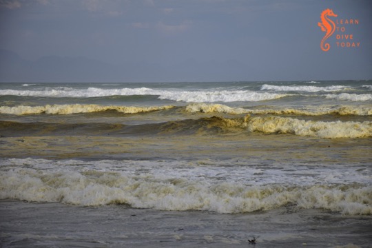
Capetonians are familiar with the tea-coloured water that runs in our mountain streams. Most people know that the brown colour comes from tannins, leached naturally from the indigenous fynbos vegetation. Perhaps less well known is the reason for the brown water that is sometimes seen in the surf zone along Muizenberg beach, stretching all the way to Strandfontein, Monwabisi and beyond.

Tea-coloured water at Muizenberg

The most frequent explanations that are offered on social media are, of course, pollution, “raw sewage”, and the like. This is not the reason for the brown water, and it does not necessarily impact the water’s safety or healthfulness for humans to swim in.

Like False Bay’s famous colour fronts, the reason for the brown waves at Muizenberg beach turns out to have much to do with the topography of False Bay, particularly of the kilometres-long beach at its head (Muizenberg-Strandfontein-Macassar-Monwabisi), and something called a diatom.

View of Muizenberg showing patches of brown water

Diatoms

Diatoms are a type of phytoplankton (plant plankton or microalgae). They are single celled, usually symmetrically shaped organisms that multiply by dividing in half at a constant rate. Their cell walls are made of silica, SiO2. Chicken keepers and gardeners may be familiar with diatomaceous earth – this is made up of the fossilised shells of ancient diatoms.

Diatoms are what are called primary producers or autotrophs, meaning that they generate organic material from carbon dioxide and other inorganic nutrients (for example nitrates and phosphates), through the process of photosynthesis, which uses light as an energy source. Primary producers sit at the base of the food chain and all life relies on them, directly or indirectly. Everything else produces organic material from other organic material (such as diatoms).

I am telling you all about diatoms because the brown water at Muizenberg contains an accumulation of a diatom that you can call Anaulus australis Drebes et Schultz the first time you mention it, but usually just Anaulus australis, or Anaulus for short. There are several members of the genus Anaulus, but usually just one tends to be dominant at each beach where these accumulations occur, and Anaulus australis is the main species found along the South African coast.

Analaus are pillow-shaped diatoms. If you wanted to see what an individual Anaulus diatom looked like, you’d use a microscope, but when enough of them are in one place, they can be seen to change the colour of the water. There’s a picture of them under a microscope at the bottom of this webpage (they also occur in Brazil). They occur at beaches with particular topograhical characteristics, which explains why you haven’t seen them at Camps Bay, Kogel Bay, or Scarborough.

At hospitable beaches, the diatoms are always there, spending much of the time lying dormant in the sand behind the surf zone. A proportion of the diatom population is able to survive for relatively long periods (estimated to be more than two months) like this, in the dark on the seabed, not photosynthesising or dividing, until the correct meteorological conditions arise for an accumulation. But first – what sorts of beaches are hospitable to Anaulus?

Brown water in the surf zone at Muizenberg

Topographical conditions

There are five physical features of coasts that are prone to diatom accumulations. They are:

  1. a high-energy sandy – not rocky – shore
  2. a long beach, more than 4 kilometres in extent
  3. the presence of rip currents
  4. a surf zone at least 150 metres wide
  5. a nutrient source close to the surf zone (often an unconfined aquifer overlaid by a dune field)

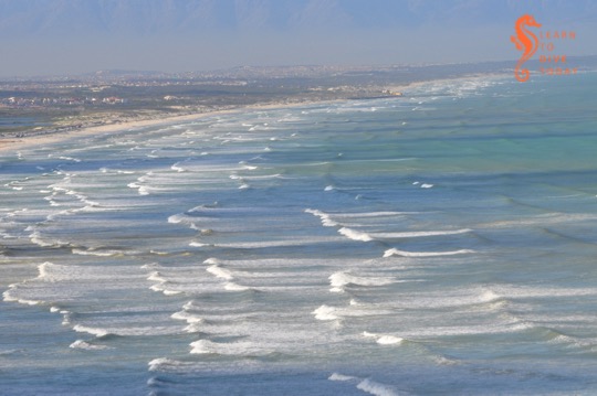
Muizenberg and Strandfontein beach tick all these boxes. The beach stretches from Surfers Corner all the way across the top of False Bay to Monwabisi, a distance of over 20 kilometres. It is a high energy beach, meaning that it is exposed to large waves and strong winds, and is not protected by any offshore features such as sandbars or headlands that might reduce the force of the waves. Rip currents do occur at the beach, and both these and the exceptionally wide surf zone – wider during south easterly winds in summer – can be observed from the mountainside on Boyes Drive. (A rip current is like a hidden river flowing out to sea from the beach. The Sydney Morning Herald has an excellent visual explainer of rip currents here.)

The head of False Bay where Muizenberg is situated is incredibly nutrient-rich, much of it thanks to urbanisation. The canalised Zandvlei estuary – the only vaguely functional one on False Bay’s coast – is situated a short distance down the beach, and supplies nitrates, phosphates and other nutrients to the surf zone. Many of these nutrients are technically pollutants, added to the river further upstream. The Cape Flats Waste Water Treatment plant at Strandfontein also discharges 200 million litres of treated water per day (under normal, non-drought circumstances) via a canal onto Strandfontein beach. This is essentially an artificial estuary for Zeekoevlei. This waste water has spent some time working its way through the settlement ponds at Strandfontein, but is nevertheless rich in ammonia and other nutrients, and Anaulus accumulations are a very common sight in the surf around this discharge point. The dunes that run along Baden Powell drive overlay a high water table, and groundwater seepage – specially during times of heavy rainfall – may also leach nutrients out of the ground and into the surf zone.

Meteorological conditions

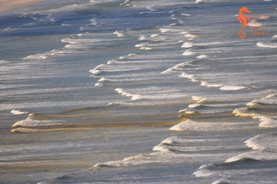
The meteorological conditions required for an Anaulus accumulation involve strong wind and a large swell. These act together to create rough sea conditions, which stir up the dormant diatoms from the ocean floor. The diatoms adhere to air bubbles in the surf zone, staying suspended in the water column, which is when you would notice the water turning brown. Exposed to light, they awaken from their dormant state and start to photosynthesise, take up nutrients, divide and multiply. The presence of rip currents creates an onshore-offshore flow all along the beach. This forms a semi-closed ecosystem, and the diatoms are essentially trapped in gyres in the waves. Longshore currents that run parallel to the beach transport Anaulus cells out of the surf zone at one end, and bring fresh (sea)water in at the other end of the beach.

It may seem surprising that anything manages to accumulate in the waves of a beach, but the surf zone is actually quite retentive, meaning that things that end up there often tend to stay there. (Incidentally, this is why it’s a terrible idea to discharge the byproduct of reverse osmosis seawater desalination –  a super-salty brine – into the surf zone. It must be discharged offshore so that it can disperse and mix with the surrounding water.)

Diatoms in the surf zone at Muizenberg

You’ll notice that, contrary to what you may have seen when large amounts of plankton are under discussion, I’ve been using the word “accumulation” instead of “bloom” to talk about Anaulus. This is deliberate, because of the constant presence and constant rate of division of the diatoms. When the water goes brown, it doesn’t mean that Anaulus is suddenly multiplying faster than usual. It means that it’s all been gathered together in patches, is exposed to light and therefore photosynthesising (at its usual steady rate), and is thus more visible than it was when it was lying on the ocean floor.

Anaulus at Muizenberg in November 2017

The human factor

You may also be thinking that everything I’ve said about the nutrients that Anaulus requires to survive and thrive points to the fact that humans – and pollution – are ultimately responsible for these brown-water plankton accumulations at Muizenberg. Well yes, in a way. But accumulations of Anaulus australis and related species have been observed and documented for well over 100 years at suitable beaches around the world, and are a natural phenomenon.

Yes, we are providing more nutrients to the False Bay diatom population than they would otherwise have received without human settlement in the greater Cape Town area, but these accumulations would likely occur regardless. They are certainly more intense now than they would have been in the past, but estuaries are nutrient-rich locations even when not surrounded by a large city. Furthermore, the water table is high on the Cape Flats, which would supply nutrients to the surf zone regardless of whether humans lived nearby.

Anaulus is in fact performing a vital and useful function by mopping up the excess nutrients that the city discharges in the ocean. The mass of diatoms – primary producers – also provides a food source to bivalves such as mussels, and other invertebrates. We can be grateful that the excess nutrients that urbanisation directs towards the ocean at the head of False Bay leads only to accumulations of harmless diatoms, rather than to frequent occurrences of harmful algal blooms that can kill marine life and exacerbate respiratory problems in humans.

Muizenberg during a diatom aggregation

Sources

Most of the original scientific study on surf zone diatoms in South Africa was done by a group of researchers (primarily M Talbot, Eileen Campbell and Guy Bate) from the University of Port Elizabeth, working at the Sundays River Beach in the Eastern Cape. I did quite a bit of reading to research this post, but you can start with this paper for a description of the topographical characteristics of beaches where surf zone diatoms accumulate. The first few chapters of this Masters thesis also provide a good overall survey of what is known about surf zone diatoms.

Putting knowledge into practice

Not every instance of brown, foamy water at the beach will be an Anaulus accumulation. On the west coast of South Africa, for example, there are no beaches where Anaulus occurs, but you may see brownish foam that is the result of heavy wave action frothing up organic matter in the surf (nothing sinister – there is a lot of organic material in the ocean). A clue to help you distinguish diatom accumulations from other brown-water phenomena – apart from running through the checklist of required beach characteristics above – is that an Anaulus accumulation doesn’t stretch much beyond the back of the surf zone. If the brown water stretches beyond the furthest row of waves, it’s probably something else. (And this seems like an apposite time to remind you that sewage looks whitish-grey, not brown, when it’s pumped out into the ocean.)

The number of beaches worldwide where surf zone diatom accumulations occur is so small – less than 100 – that Odebrecht et al could enumerate them in a 2013 paper. I hope this helps to convince you that the brown water at Muizenberg beach (and beyond) is something special and interesting, not to be feared. Go surfing!

Bookshelf: Life’s a Beach

Life’s a Beach: Your Round-The-Coast Guide To South African Beaches – Ann Gadd

Compliments of the season. If you’re contemplating which beach to head to for tomorrow’s traditional Boxing Day beach outing, a venerable South African institution, I have just the book for you. The product of a mammoth investment of time (which couldn’t have been all bad) and distance travelled, Life’s a Beach is a handy guide to (possibly, probably, almost) every single beach along South Africa’s coastline.

Life's a Beach
Life’s a Beach

Each pair of facing pages covers a stretch of coast, and beaches are rated for surfing, alongside information about swimming, kiteboarding, wake boarding, kayaking and canoeing, diving, fishing and hiking. The scuba diving information for the sites around the Cape Peninsula, with which I am familiar, is reasonable, but of necessity very abbreviated owing to the book’s format and primary focus. It goes without saying that you should seek out some local knowledge before diving in an area you haven’t visited before.

Unique experiences and best kept secrets (no longer – haha!) are highlighted, as well as the presence of braai and picnic facilities. Tips on where to go for sundowners are also included. Child friendly activities are mentioned where applicable, too.

Access tips, as well as warnings about rips, pollution, sharks (thank you Shark Spotters!) and whether a beach has Blue Flag status round off the comprehensive information that is provided in a handily concise manner. This book will be extremely useful when you’re visiting an unfamiliar stretch of South Africa’s coastline, and particularly invaluable when it’s a little known and less popular beach.

Get a copy of the book here, or here if you’re outside South Africa.

And if you’re going to the beach in Cape Town tomorrow, make sure you’ve downloaded the free Shark Spotters smartphone app. Get it here for your iPhone, and here for Android.

Newsletter: Keeping current

Hi divers

Weekend dive plans

No diving

We dived Long Beach today in surge, strong current and lousy visibility. It is full moon and we have had some swell but I was hoping it would be ok – it wasn’t.

Weekend conditions do not look ideal for recreational (fun!) diving. Better luck next week I hope.

Rock lobster munching a sea jelly

Date to diarise

There’s a talk on South Africa’s inshore marine resources, with special reference to West Coast rock lobster stocks, happening on Wednesday 18 October under the auspices of Kommetjie Environmental Awareness Group. It starts at 7.30pm at Kommetjie Christian Church. There’s a blurb with more info here. It should be an extremely interesting event, and I’d particularly encourage you to attend if you are a keen crayfisher in season…

regards

Tony Lindeque
076 817 1099
www.learntodivetoday.co.za
www.learntodivetoday.co.za/blog/

Diving is addictive!

To subscribe to receive this newsletter by email, use the form on this page!

Bookshelf: Into a Raging Sea

Into a Raging Sea: Great South African Rescues – Tony Weaver & Andrew Ingram

I insensitively packed this book for Tony to read while we were aboard MSC Sinfonia for the BirdLife cruise we took in April. It’s a rip-roaring read about various rescues that the NSRI has been involved with over the years, but – perhaps unsurprisingly – Tony wasn’t keen to read about maritime disasters (even ones that ended well) while we were at sea.

Into a Raging Sea
Into a Raging Sea

The book was produced to commemorate the 50th anniversary of the NSRI. There is an element of history – describing the origins of the organisation, and some “sea rescues of yesteryear”. But the bulk of the book describes rescues that took place in the last 15 years. Some of them, such as the sinking of the whale watching boat Miroshga off Hout Bay’s Duiker Island, will be all too familiar from the ensuing press coverage. Others were less familiar, but no less interesting to read about.

One of the things I loved about this book was that it reveals the men and women behind the daring, often dangerous rescues. The rescuers are allowed to recount the events they experienced, using their own words, and this is revealing. These rescuers are not usually lionised by the general public or, as a rule, afforded prolonged media attention, and neither does this book glamorise them or romanticise their achievements. The challenge of the rescues – and occasional raw fear felt by the rescuers –  are vividly portrayed. The writing is beautifully matter of fact, without downplaying the seamanship, strength of character and perseverance required to do this (unpaid) work.

It reminded me fondly of the “drama in real life” stories that I used to devour from the pages of the Readers Digest magazines my grandmother used to bring whenever she came to visit. There are many, short chapters, each one offering its own little catharsis. The rescues span South Africa’s coastline, as well as a few other locations, and not all of them are maritime disasters.

Proceeds of this book support the NSRI. Get a copy for yourself, and all your friends. It will entertain anyone who loves a good story of heroism and adventure, and it will encourage anyone who’s feeling jaded about humanity’s capacity for good. It’s an excellent read.

You can find a copy on Loot if you’re in South Africa, otherwise here or here.

Newsletter: Turtle time

Hi divers

Weekend dive plans

Sunday: Boat dives from Simon’s Town jetty at 10.00 and 12.00, likely to Roman Rock (suitable for Open Water divers)

The weekend looks good for diving. We’ll be boat diving on Sunday. If you want to join us, you know what to do!

Green turtle on the move

Turtles

It’s that time of year when turtle hatchlings get caught up in currents that bring them to Western Cape shores, where it’s too cold for them to survive. If you find one on the beach, please keep it dry and warm, and get it to the Two Oceans Aquarium as soon as possible. Read more about what to do on the aquarium blog here, and here.

regards

Tony Lindeque
076 817 1099
www.learntodivetoday.co.za
www.learntodivetoday.co.za/blog/

Diving is addictive!

To subscribe to receive this newsletter by email, use the form on this page!

Newsletter: Slightly swelly

Hi divers

Weekend dive plans

Sunday and Monday: Boat dives (location to be decided)

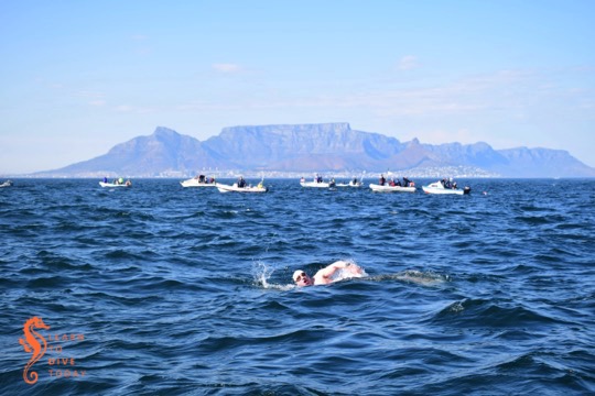
Last weekend we did some boating in Table Bay as a support boat for the Robben Island to Big Bay Freedom Swim. The remnants of the swell on Thursday and Friday was enough to give the swimmers a sizeable challenge with strong currents, choppy surface conditions and very cold patches of water.

Colin swimming across Table Bay

The swell climbed from under 2 metres to a little over 5 metres this morning.  This means diving tomorrow is pretty much out, as is diving on Saturday (thanks also to the Two Oceans Marathon). The swell drops off during the day on Saturday so both Sunday and Monday should deliver some reasonable diving conditions.

It is difficult to say whether Hout Bay or False Bay would be better on Sunday and Monday, but I will make that decision late on Saturday afternoon. I have Open Water and Advanced Open Water students so one day is likely to include a deep dive to more than 18 metres.

If you are keen to dive on Sunday or Monday, let me know and I’ll schedule you in!

regards

Tony Lindeque
076 817 1099
www.learntodivetoday.co.za
www.learntodivetoday.co.za/blog/

Diving is addictive!

To subscribe to receive this newsletter by email, use the form on this page!

Colour fronts in False Bay

Colour front seen from Sunny Cove on 27 November 2015

Perhaps you have wondered what causes the patterns of strange coloured water in False Bay during the summer months. Perhaps you have dived in it, and wondered why sometimes you can’t see your hand in front of your face! Wonder no more – I am here to help.

Colour fronts

Frequent visitors to and residents of the shores of False Bay will observe that at certain times of the year, the ocean is marked by bands and arcs of sharply contrasting coloured water. This phenomenon is known as a colour front. In oceanography, a front is the interface or boundary between two separate masses of water. In this case, the water masses are easy to discern, because they are of different colours. There are usually other characteristics of the water on each side of the front that differ, too. Fronts are either convergent (the water masses are moving towards each other) or divergent. The presence of marine debris (like pieces of kelp) at the front boundary suggests that it is convergent.

Causes of colour fronts in False Bay

Prior to 2005, there was much conjecture about the causes of these fronts (including the usual pollution bugbear), but little evidence to support any of the theories. By sampling, the fronts were found not to be caused by pollution, or by plankton blooms in the surf zone. It was known that a colour front was most likely to occur in False Bay after a period of southerly or south easterly wind lasting a few days. October and November seem to be prime months for the phenomenon.

When a large, obvious colour front arose near Simon’s Town in November 2005 with milky green water on one side, and darker blue-green water on the other, researchers from UCT and IMT sprang into action, sampling the water on each side of the boundary so that they could measure its characteristics. Speed is of the essence in these situations; colour fronts can disappear quickly. The one in the picture below is busy decaying – notice the smudged boundary.

Colour front in north western False Bay on 13 November 2014

Measurements revealed that the milky green water overlaid the clearer, bluer water, down to a depth of 11-12 metres (this will vary from front to front). The milky water did not extend to the ocean floor.  Scuba divers around the Cape Peninsula will be familiar with the experience of diving through two or more layers of water, with varying turbidity (clarity) and temperature! (Here is picture of Tony and Christo diving near Oudekraal in the Atlantic that shows what the boundary between two layers of water can look like.)

The researchers found that the milky coloured greenish water was full of fine, almost neutrally buoyant particles of calcium-rich sediment. The green-blue water contained much less calcium, but relatively more silicon, which would suggest the presence of diatoms (a kind of phytoplankton – you can think of them as teeny tiny plant-like organisms) or sand in the water. The origins of the calcium-enriched sediment in the milky water are interesting: one source is from the shallows (less than 30 metres deep) of north western corner of False Bay, where the ocean floor is made up of rocks that are rich in calcium carbonate (such calcrete and limestone), some areas covered by a thin layer of sand.

Milky-white water near Swartklip on 29 November 2014

The second probable origin for the particles of calcium-rich material is the interface between the sea and the land at the northern end of False Bay. The cliffs at Wolfgat/Swartklip at the head of the bay are made of calcrete, and at Swartklip the beach narrows to the extent that the cliffs erode directly into the water when the sea is high. Strong southerly winds create a wide (of the order of one kilometre) surf zone at Muizenberg and Strandfontein; a spring tide also adds to ideal conditions for the generation of a colour front.

The temperature of the milky water was found to be slightly (0.4 degrees Celcius) higher than the green-blue water. This measurement will also vary from front to front. The researchers speculate that the temperature difference could be because the milky water originated in the surf zone, which is shallower and therefore warmer, or because the high concentration of suspended particles in the milky water caused greater absorption of heat from the sun.

Colour front at Smitswinkel Bay on 24 October 2014

Summary

Here’s the tl;dr: strong southerly and/or south easterly winds, perhaps coupled with spring tide conditions, set up a very wide surf zone along the northern end of False Bay, which disturbs the sediment on the ocean bottom and drives the waves further up the beach than usual. Particles of buoyant calcium carbonate from the sea floor and eroded from the cliffs at Swartklip are lifted up into the water column, changing its colour to a milky-green shade. Wind-driven circulation patterns in the bay push the front from its original location in a southerly direction, towards Simon’s Town.

What to do?

Contrary to what your friends on social media may claim, not all colour changes in the ocean around Cape Town can be attributed to a giant sewerage plume. Hardly any of them can, in fact. In summer, the reason for the ocean looking green, red or even brown is likely to do with a plankton bloom of some description, or related to suspended sediments (as in this case) or other naturally arising material in the water. Instead of using this as an opportunity to become hysterical on the internet, how about celebrating the incredibly dynamic system that we can observe, living near the ocean? Drive up a mountain next to the ocean and take in the spectacle from on high. Dip your face in the water and see what it does to the viz. Take some pictures for posterity. And – if you don’t know what’s causing it – try to find and question someone who does know, like a scientist, or consult a good non-fiction book, to find out some facts.

If you’d like to read more about colour fronts in False Bay, take a look at this scientific paper (pdf), which I used as source material for most of this post. The paper is called A Prominent Colour Front in False Bay: Cross-frontal structure, composition and origin

Article: Wired on giant ocean eddies

Scientists have discovered giant eddies, 100 kilometres across, making their leisurely way across the world’s oceans. The rotational effect extends up to a kilometre below the ocean’s surface. They are quite beautiful when visualised (if you were in one you probably wouldn’t notice – they move very slowly). Wired.com covered this discovery in an article last year.

Read the Wired article here. Bear in mind that the colours in the maps represent height of the ocean surface, not temperature!

If ocean circulation interests you, I cannot recommend Flotsametrics highly enough. You should also check out NASA’s Perpetual Ocean, and their global sea surface temperature and currents map. The Gulf Stream is also quite informative.